Wednesday, June 25, 2014

The Blackmare Trip That Wasn't - Part 1

The plan was simple.

Hike as far as we could towards the Blackmare No Trail turn off from the Gold Fork trailhead. Spend the night either at Stump Lake, to go on to Blackmare in the morning, or at Blackmare, if our speed was adequate to get us to the trail before dark.

This plan didn’t survive its engagement with the snow.

Though it started off well enough. . .

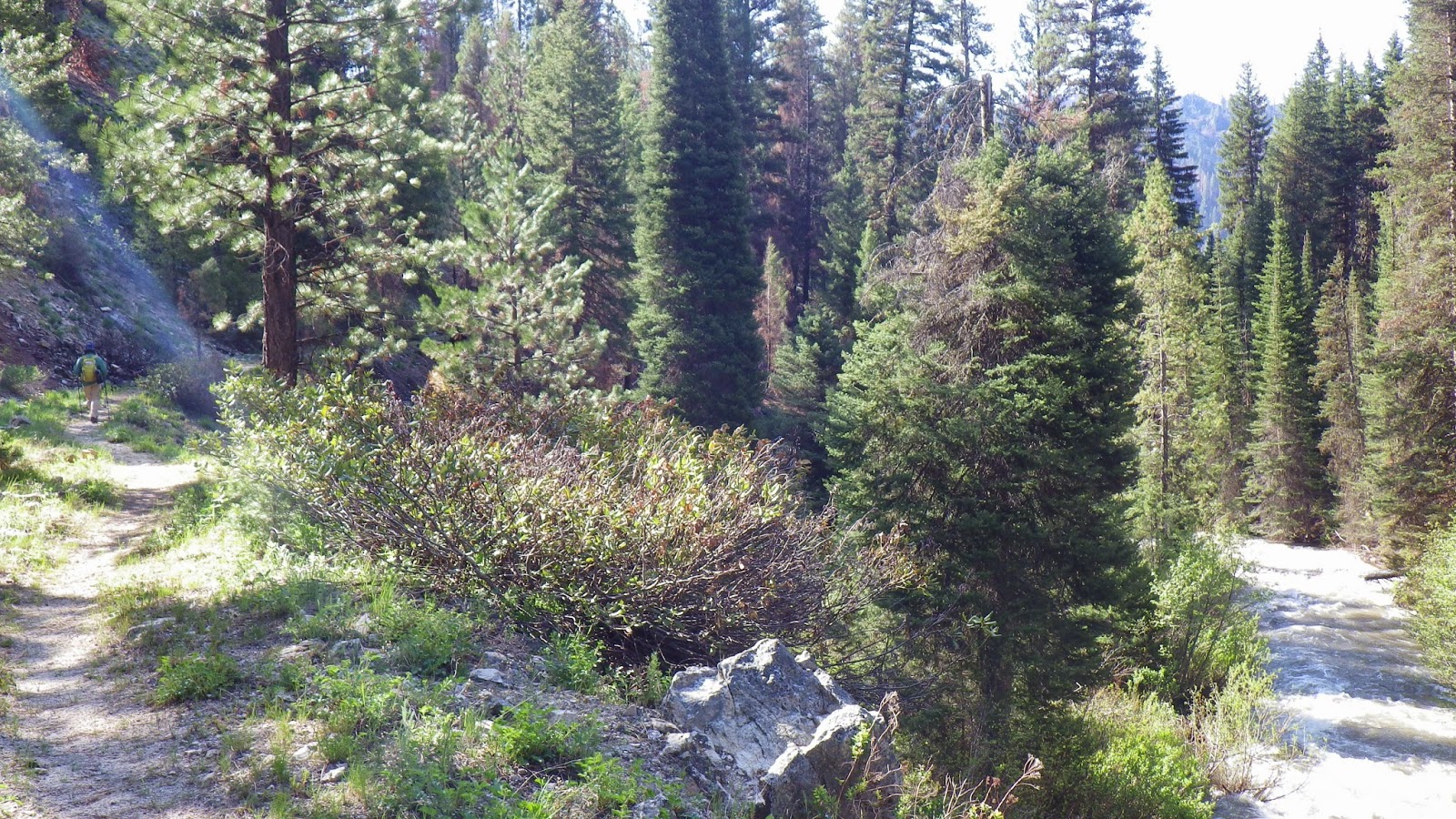
We drove up on Thursday night. The plan was for me to take Friday and Monday off of work so we could make a long weekend out of it. We made it to the Gold Fork trailhead well before sunset and set up the car camping tent. We had brought our down blanket from home so we wouldn’t have to unpack sleeping bags, and in the 50 degree weather, it worked quite well. I had a new sleeping pad, a Thermarest Neoair that weighs less than a pound. Its warmth rating is less than my old pad, but I thought I could handle it. The weather has been warmer, and I’ve been sleeping warmer as well.
What could possibly go wrong?
The night was good. We slept well and left camp around 6am after taking down the car camping tent and parking the car away from the main camping area. Since we weren’t planning on spending another night there, it would be rude to claim the area for the entire time that we’d be gone.
The Gold Fork Trailhead - no snow in sight. 
The air was cool, and we both wore our lightweight raincoats and gloves as we started down the familiar trail. Ambrose and I agreed that I could go at my faster pace and meet him at what we call Shit Creek, because the crossing would be difficult with how swollen the other streams we’d seen this year. I didn’t go as fast as I could, but I went faster than Ambrose. Until I reached Nail Creek.
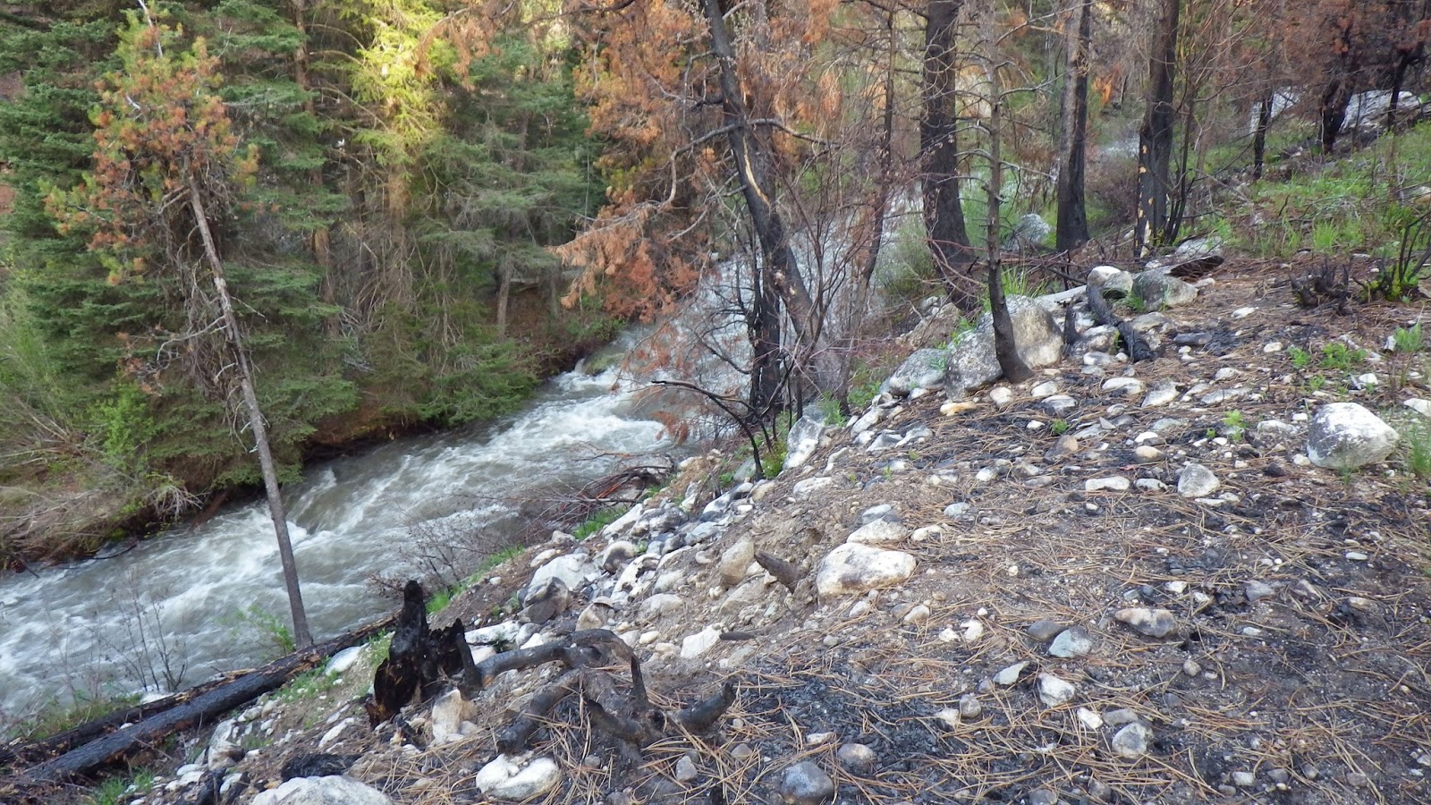
This stream dries up later in the summer.
In late summer, that creek is usually shallow enough to ford without thought, but what I saw before me was deep and wide. I thought about going back for my sandals to do a crossing, and I decided to wait for Ambrose. He didn’t keep me waiting long, and reminded me of the log crossing just a short way downstream. We crossed on the log and I went off again.

When the trail grew steep, I unzipped my jacket to vent, but did not think to take it off. It was actually colder than it had been earlier according to the altimeter/barometer, dropping down to the low 40s.
Forgotten Creek seems to flow from underneath the roots of a large tree.
I moved on past Forgotten Creek without waiting for Ambrose, since an old tree’s roots bridge the small stream just upstream of the trail. Not long after crossing it, I saw the first hint of what was to come.

A pile of snow alongside the trail.
The snow near Shit Creek covered the trail, but didn't conceal it.
Just before Shit Creek, snow covered the trail. I wasn’t worried at that point. There’s been snow leading up to that crossing before, and I knew that would likely mean some snow higher up. But I wasn’t worried. I didn’t think there would be that much snow. Mounds covering the trail maybe, and a few sections of having to find the trail.

Nothing to worry about, right?
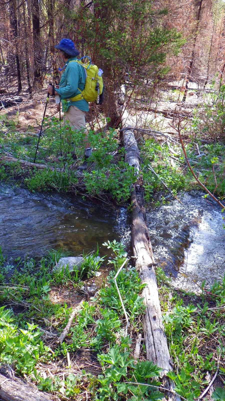
Yes, we crossed this swollen stream on those two wet logs. 
I waited for Ambrose. The water was high enough that the two log crossing was wet on the far bank. In the past, we’ve walked across the logs, but this time, we sat on them and scooted. Ambrose opted for a side-saddle position, keeping both of his legs upstream where there was a rock he could use to help push himself across at the halfway point. I put one leg on either side of the pair of logs and scooted that way. Straddling two logs of differing sizes is more difficult than scooting across a single log, and the water was high enough that my boots would touch the water and get jerked by the current. Not to mention the wet part of the log was cold and slick. But we made it across and agreed to meet again at the fire camp, a section of the trail that is still quite burned out and consists mostly of rocks and sand.

I zipped on up the steep hill that I once called never-ending, but that now seems not so bad. It is still steep, and challenging in part because of the loose rock composing the dirt of the trail, but I am in much better shape to climb it than I used to be. I reached the top and stopped to take care of a call of nature. I thought for sure that Ambrose would catch up to me while I stopped, but he didn’t come into sight until after I had completed my business and started hiking away.
More snow layered over the trail. 
Of course, I hiked away as quickly as I could. I wasn’t about to let him catch me, even when mounds of snow began appearing on the trail. It wasn’t like the snow was obscuring the trail at that point. It was just a little awkward to get through, especially when my boot punched through a soft crust and I found myself knee deep in a pile of snow.

I put my gaiters on, but the gaiters that I had were not really meant for boots. I bought them for trail running, but they were all I had, so I tried to use them. With my thick socks on, they were way too tight, causing immediate pain in my calves. So I undid the top snap, which still left them snugly wrapped around my leg to just above my boot.

As I approached the trail junction where I would turn on to the Needles pack trail, the snow gradually disappeared. I had to detour around a huge treefall to get to the fire camp, but since that area lacks brush, it wasn’t a big deal to walk around it. I moved past the saddle to try and hide from the wind before sitting on the ground and eating a snack while I waited for Ambrose to catch up.
The trail required a small detour around this huge tree. 
He became a little alarmed when he couldn’t see me right away, but I came into view before he could get really worried. Based on the snow, he wanted me to stay close instead of zipping off. I thought about proposing that I would stop if the snow became prominent, but I didn’t feel like an argument would be fun.

So I didn’t say anything and kept him in sight as I hiked.

It wasn’t that much of an effort to stay close, because he would catch up as I stopped to take pictures. I was cold, but the snack had helped, and Ambrose and I were going to stop and make some coffee when we next ran into running water. There’s nothing like a hot, sweet drink to lift the spirits on a backpacking trip.

Although, the fact that the next running water we came upon was in a swampy section in the middle of a burned area, with very little protection from the wind, detracted a bit from the blissful sweetness of the latte mix. It was still good to get a break, and to wrap my cold hands around a bottle of warmth. Getting the pack off my back for a spell also gave me a burst of energy that kept my spirits up all the way to the return to the woods.

We descended into the the living forest and soon came upon more and more piles of snow. At first, there were just mounds above the trail and to the sides of it. Then the mounds got larger. Soon the snow was more predominant than the dirt. Snow melt streams flowed underneath sections of the snow-covered trail, making the crossings deceptively treacherous.
The snow begins to encroach.
At a steep uphill section that followed the Gold Fork River, the snow became less prominent again, but my relief at that respite was short-lived. Once we hit the top of that section, snow was everywhere.
Ambrose on the snow.
I’m not sure why we never talked about going back. I think we both felt that we knew the trail well enough to keep going despite the snow, and that we both had this hope that it would get better. There might also have been a hint of macho behavior. We wanted to prove to ourselves that we could handle this. Snow travel is a lot harder than travel on dirt. It’s like walking in sand, only sand doesn’t usually have random sinkholes.
The Gold Fork was in full spate - and periodically covered in snow.
You can be walking along on the snow, taking care with your steps, and still find yourself crashing through what turned out to be a thin crust of snow above a hole. At one point, I sank nearly to my hip. I had to find stable footing and lift myself, and my pack, up and out.

We followed the trail by keeping an eye out for blazes on trees. Trees tend to have a well around them where snow doesn’t accumulate. This allowed us to see the blazes on trunks, even if we sometimes had to get very close to the tree to see the blaze down in the well.
Most fallen trees were under the snow rather than lying on top of it.
In some ways, the snow did ease our travel. There’s no need to detour around brush or small trees, and when there is a steep uphill section, you can carve out stairs with kick-steps. It’s great exercise.

We made it to our alpine lakes for lunch. Not a word about turning back, even when we got a little lost after lunch finding the trail again. The sky kept threatening rain, and I told it I would prefer snow, because I had neglected to bring a pack cover (something I didn’t want to admit to Ambrose).
The clouds were dark and the trail was covered.
We lost our way a few more times on the way to the saddle below the Needles. At one point, Ambrose wanted to follow the trail the deer had left. I was against that course. Eventually, we did find the trail by working together, taking turns to explore avenues that we thought were correct.
Tree wells could conceal blazes. 
As we approached the saddle, I was telling myself that there was no way I would go down the steep switchback if it were covered in snow. I had a hard enough time doing that section when it was bare and dry, and I would dig in my heels if it were wet and covered.

I reached the top ahead of Ambrose. I had kick-stepped stairs in the snow for him, but it was still hard work for him to get up them and sometimes widen them for his larger boots. The first section of the switchback was clear and I was elated.
Look, ma! No snow!
We stopped for a snack in the lee of some rocks, and then started down the switchback. It quickly disappointed me by revealing yet more mounds of snow. I proposed going off trail rather than trying to navigate the snow that was thinly covering rocks. Ambrose agreed, because we knew that the trail basically traversed the ridgeline from the saddle to Needles Summit.
Ambrose hikes up to the saddle.
We lost the trail. Found it. Lost it.

It began to snow. Then harder. Hard enough that I asked Ambrose what we would do if it became a whiteout.
Small pellets of snow - a picture taken before my morale fell too low to take pictures.
We saw an approachable saddle and went to the top of it to have a look and make sure it wasn’t the Needles Summit. We were pretty sure that it wasn’t, because the terrain didn’t look right, but with all the snow, none of the terrain looked quite right. We looked down into a valley where we should have been able to see Blackmare Lake.

We saw snow. A tempest of swirling, blizzarding snow.

Now that I’m safe, warm and dry, I wish I had taken a picture. At the time, I felt demoralized. I was holding a sense of panic down tightly. I felt as if taking a picture would take that storm with me. I could not bring myself to do it.

So you’ll have to take my word for it. The only thing to be seen was white snow and dark clouds. We kept traversing.

Sections of the trail would look familiar, but there were not enough blazes to guarantee that we were actually on it. I was scared that one of us would slip and fall down the ridge. I thought about how I would climb up from a slide down. Unless I broke something. . . I couldn’t carry Ambrose if he got hurt. I didn’t think he could carry me far.

I took care as a remedy against panic. Careful steps, finding the trail and making my way. I followed Ambrose when I ran low on energy and I led when I could.

When we reached the Needles Summit, I kissed the sign and insisted that Ambrose take a picture of me with it.
We made it to the Needles Summit without mishap. And with cold. Lots of cold.
Then I led the way down to Stump Lake.

It took us 12 hours to travel less than 6.5 miles.

Well, maybe a bit more than 6.5 miles with the getting lost detours. . . but that's still a snail's hiking pace.

The fire pit where we usually camped was completely covered in snow. We managed to find a flat-ish spot not covered in snow that was just large enough for the tent.

I began to pitch the tent. I got the poles backwards and looked over at Ambrose. He was just standing there, watching me, and I was irritated.

“What are you doing?” I asked.

“Watching you,” he said.

I huffed and dug out the cooking kit. I asked him, as politely as I could manage, to start working on dinner. Then I turned the poles around and got the tent up. I tossed our sleeping pads, sleeping bags, spare clothes and food into the tent. With the weather being the way it was, we weren’t worried about bears or critters.

I changed into dry socks, long underwear and answered a call of nature while Ambrose cooked. He took a break to change into his own dry socks and clothes. I crawled into my sleeping bag and tried to get warm, but it wasn’t easy.
Stump Lake, covered in snow.
My legs and feet felt icy, even deep in my down sleeping bag. After we ate dinner, Ambrose suggested that I put my rain pants on. I ended up wearing long underwear pants, rain pants, boot socks, long underwear shirt, rain coat, balaclava, gloves and sun hat with the rain coat hood pulled snugly around my face.

Still cold.

Ambrose snuggled in next to me, and we had The Talk.

What would we do tomorrow? Our four day trip was no longer the trip we had planned. There was no way we would make it to Blackmare on an unmaintained trail that we had never hiked before. Ambrose suggested turning back the next morning. I suggested waiting to see what the next day was like. If it were sunny and nice, then we could hang out at Stump Lake and get dry, maybe spend another night and then head back. If it were nasty, then we could high tail it back to the car as fast as possible.

To be continued...

Wednesday, June 18, 2014

Weekend Workout

Ambrose wanted to take the weekend off of backpacking. Waters were still running high and he wanted to have a day at home to recover. I proposed that we drive out to the Sheep Creek trailhead on Friday night, hike out about a mile and camp overnight in preparation to do a speedy run of 6125 on Saturday morning before driving home that afternoon.

6125 is what we call the route that we take to an elevation overlooking Twin Springs, ID. It is relatively short at 3.2 miles one way, but packs quite the elevation gain at approximately 3000 feet. Last year, my best time was around 4 hours, and Ambrose’s was around 6. I hoped that we would each improve, because we had spent the winter working our butts off at the gym in anticipation of a stronger hiking season.

So that’s just what we did.

We arrived at the trailhead before dark and parked the car in a wide gravel area at the side of the road overlooking the river. Then we gathered up our packs and headed off for our first actual backpacking trip of the season - the last two trips were car camping with day hikes. I was feeling a bit ill, so I opted to follow Ambrose rather than zip off to our destination. I tend to get dehydrated on our long drives into the wilds because our car doesn’t have air conditioning.

We moved at a good pace, and reached the established camp site in good time. This site has a fire pit and boards on rocks set up as benches. It is very close to Sheep Creek, and the sound of the water makes it difficult to hear anything but the rushing flow and the occasional glorping thud of rocks moving in the water.
I set up the tent while Ambrose filled up our water bladders and got himself settled. It was easy to fall asleep in the tent with the white noise of the water covering Ambrose’s snores.
The tent is set up close to the river. 

This site has plank benches and a fire pit.

Not so easy to get up in the morning, but that’s typical with me. I try to be more cheerful than I feel in the mornings, because that makes for a better day, but I still prefer to sleep in over getting up at 5am. Still, the sooner we began the hike, the sooner it would be over and we could head home.

It isn’t that I don’t like hiking… it’s just that this hike is particularly evil, and has been a bit of a trial for me since we began to do it last year. Once again, it comes down to the ilio-tibial band issue on my right leg. I’ve been able to get around it, adjust my gait and figure out ways to prevent the pain from recurring, but it would be severely tested by coming down those 3000 feet, which, at many points, were ridiculously steep. On one trip last year, I came down in total pain the entire route, and had to endure the additional salt of Ambrose passing me. I’d had success in downhill hiking so far this year, but this could be different.

Ambrose insisted that we start the hike together, because after we crossed a bridge over Sheep Creek, we would have to cross a small stream that feeds into it. I scoffed, because my memory of the feeder was that it was no more than a hop wide, but the memory of the Queen’s River’s swollen depths made me agree with him.

Just in case.

The small stream was not very far from where we began, and it was exactly as I remembered it. I smiled, but didn’t gloat too much. I hope.

Then I was out of there. Ambrose paused to take his rain jacket off. He had worn it because the morning was chilly. I hadn’t worn mine, because I knew that I was about to work hard enough to ignore the cold. I was just getting into a rhythm when I came to the last flat spot I’d see for a while, a meadow up above the creek. I saw three deer streaking away from the water, and I paused to take them in and snap a picture. I even turned to see if I could share the moment with Ambrose, but he was nowhere in sight so I moved on to the beginning of the steeps.
Two deer ran ahead while the rearguard followed up.
The trail is open to motorbikes, which means that portions of it have been reduced to a pile of ball bearings thinly disguised as rocks and other parts are narrow singletrack. I was delighted to find that stepping with one foot directly in front of the other in the singletrack sections did not cause my knee to flare with pain. The ball bearings… well, my trekking poles helped a bit with those sections, but it can still be quite frustrating when your footing slides beneath your step.

I break down trails that I travel frequently into sections. 6125 has the section near Sheep Creek, the meadow, and then a series of ridges and valleys that must be traversed, all while climbing up, up, up. The first is the one with the trees. Then there’s the “W,” so named because of its shape. Next is the scar, where a large scrape of gravel cuts across the path. Finally, there’s the saddle, where the path tops the ridge and begins to follow it.
The day started off cloudy. 
I hustled. I definitely didn’t want Ambrose to catch me, even though I wanted him to do well. I turned back to look every now and then, but never caught a glimpse of him. As I started the approach to the saddle, my left boot felt loose. I was planning on re-tying my shoes at the saddle. I didn't want to stop, because it was hard to keep moving up the steepest section. But when I looked down and saw that my boot was untied, I did stop and retied both boots.

After cresting the saddle I hiked on through a section filled with bushes and flowers, continuing to head up, but not as steeply. Then there was a flatter spot, and I could see the city of Twin Springs off to my right, looking so small in the distance.
These flowers and grasses won't be green in a few weeks. 
I kept expecting the trail intersection I would take up to 6125 to appear, but it stubbornly refused. I traveled on, impatient and in a hurry. It had taken me about 1 hour and 15 minutes to get up to the saddle and I really wanted to make the top in less than 2 hours. I couldn't remember what my best time to the top had been last year, but I thought it was right around 2 hours.

The trail will get me there eventually.
Even when the intersection did finally come into sight, the distance from it to the top of the peak was longer than I thought it was. I almost started to run, but I wanted to make sure that I had the energy to make it back down without injury. When I reached the rocks that Ambrose and I use to mark our turnaround point, I sat down and had a snack and a drink. I'd made it in 1 hour and 50 minutes. I lingered on top for about 7 minutes and then headed back. I knew I'd catch Ambrose somewhere down there.
The rocks!
But he refused to appear where I expected him either. I could see the saddle from the 6125 rocks, but he wasn't there when I looked. I rounded a corner which gave me a good view into the distance and saw him.
See him?

How about with some digital zoom?
I hurried my steps to catch him as far back as I could. Once I caught him, we exchanged a kiss and chatted a bit. I let him know I was 25 minutes off of the peak (bragging? maybe a little), and then I continued hiking down and he continued hiking up.

I knew that the hardest part for me was yet to come. When I reached the saddle again, I tried to stay calm and not get panicked as I placed my steps carefully down the steep, rocky ball bearings on the trail. I thought that it would hurt. I dreaded it.

But it didn't happen.

I kept going down. I moved at a slow, steady pace. But not too slow. I marked the sections as I passed them. I hoped I could make it in less than 4 hours, and that hope got more realistic as I kept moving and didn't feel the old familiar pain in my knee.
The tree section right before the meadow is the beginning of the end.
I refused to let myself check the time as I came down. I made it to the meadow, and then to the tiny stream crossing. Just before the bridge, the trail was mostly flat, so I let myself run a little bit, hurrying to try and get the best time that I could.
The trail seems to end in the creek...
I came upon our camp site at 3 hours and 28 minutes, just after 9:30am.

I dumped my pack on the ground and took a few moments to savor a hike well done. Then I made coffee and worked on breaking camp before Ambrose got back. I had us all packed up and ready to cook lunch by the time he showed up a little more than 2 hours later. 

We ate lunch and then hiked back to the car to drive home. 

Just a nice little weekend workout. 

Wednesday, June 11, 2014

Queen's River Loop Explorations Part 2

Continued from Part 1.

Then we set off again, this time turning right to follow the Queen’s River. But not before a local rodent posed for me. I swear, Ambrose and I have already seen more animals this year than we did all of last summer. And they keep holding still and waiting for me to take their pictures. I love it.
So cute!
I also took a picture of a bearing tree. I had never seen one of these before, but apparently they are a relatively common way of marking certain boundaries. The information was hardly legible, but I was able to make out the date, 6/25/93.
The bearing tree

Close up of the bearing tree
This direction of travel did not stay as close to the river as the other direction. We could still hear it for a little while, but we lost sight of it quickly as we walked along a widening meadow in the late morning sunshine. The ground was damp in places, and some small streams had found the trail as the easiest place to flow, but none were deep enough to bother either of us.
A section of meadow between the trees
As we walked, we heard voices in the direction of the river, and, looking in that direction we saw a truck and camp all set up. For a moment, I wondered at the cajones involved in driving a pickup truck into a wilderness area, but then I realized that the camp was across the river, and, therefore, not technically in the wilderness area - just as close as you could drive to it without getting your truck wet.
Long underwear gone!
Ambrose and I kept walking for a little bit longer than he wanted to in order to get out of sight of the camp, because he had put on long underwear under his shorts when we went back to the campsite and he was now too hot. I had expected that, since it was turning into quite a nice day, and even cool weather can feel hot when you’re hiking.

We paused in a copse of trees so he could get rid of the long underwear. I took care of a call of nature while he went through the laborious process of removing and then putting back on his boots and socks. I was done first.
The trees have been partially burned
This section of trail wandered from meadows to trees, and a majority of the tree areas showed signs of recent fire. There were occasional downed limbs across the trail, but not so many as to be a burden to our hike. One of them was the perfect height for me to walk under, but Ambrose had to walk around it. Not that that was entirely a burden in that particular terrain.
I fit under the tree right next to the log, but Ambrose had to go around.
The first and second stream crossings were not difficult to cross. The water was shallow and the flow was not nearly as fast as the streams feeding the Little Queen’s River. One of them had a cute little log bridge that I tried to use as balance practice in a non-threatening context. When we came to a wider stream that had no bridging logs, Ambrose decided that he would change into his FiveFingers, which he had brought especially for this purpose, and I decided I would attempt a fording in my boots.
Cute little log bridging a cute little stream
I was wearing gaiters over my waterproof boots, so I figured that I would see just how much extra protection I got with that set up. The water looked like it might get a little deeper than the tops of my boots, but Ambrose had been telling me that I really ought to wear wet boots to create a new wear pattern inside them since I had changed my gait since first breaking them in. My only qualm was that the last time Ambrose forded a stream and got water in his boots, the tent was nearly unbearable with the stink of his feet that night.

I stepped as quickly as I could across the stream and just barely got the top of my gaiters soaked through with water. Nothing really went into my boots and I was glad about that as I waited for Ambrose to finish the process of boots off, shoes on, cross river, boots back on.
A small rise along the trail
As we walked on, the trail climbed a small elevation to a large detour. A huge tree had fallen across the path, and the detour wasn’t easy or obvious. Rocks and ash made for difficult footing as we threaded our way through.
This blocked the trail.
Soon, the trail entered another shallow stream bed. It took us a few minutes of searching before we realized that the trail was, in fact, flooded and followed the stream. I really wanted to keep going until we could see where the trail crossed the Queen’s River, but before long the trail was completely lost to the water, and I conceded that Ambrose was right about turning around.
This toad was nearly stepped on by Ambrose, but climbed back on this rock so I could take its picture.
We stopped for lunch as a relatively dry spot, and then did a forced march back to camp. I didn’t pause too often for pictures on the way back, because Ambrose wanted to hurry back and I figured we would be back out here again some time for more pictures. Considering I’m planning on doing my solo hike in that area this year, I am definitely planning to be back and to take copious amounts of pictures. It will be interesting to compare the pictures from late spring to the pictures of late summer though, even if only a few of them.
We lost the trail momentarily and I found these rusted horseshoes.

It's easy to lose the trail when the trees that could have blazes are burned.

I wonder what this meadow will look like in a couple months...

Wednesday, June 4, 2014

Queen's River Loop: Explorations Part 1

Along Middle Fork Road, there is a campsite called the Queen’s River Campground. Ambrose and I could have stopped our drive there and parked if we could find an open site, but instead we turned onto the narrow(er) China Basin Road and eased our way to the Queen’s River Trailhead. The trailhead actually did boast several campsites and even a toilet. It was also completely empty of other people. That’s where we decided to spend the night before setting off into the Sawtooth Wilderness to explore the first 5 miles of the Queen’s River Loop trail.
We had the campsite to ourselves - though a few ATVs did drive through.
At least, that was the plan…
Surprisingly, this view is in the opposite direction of the wilderness area.

Looking down at the Queen's River from China Basin Road.
The trailhead and the road, along with some convenient posts for hitching. 
After a nice night in our large car camping tent, we packed up our day packs and set off for the wilderness. The water in the Little Queen’s River was high and wild. As we walked near it, the white noise made conversation difficult. Ambrose led the way (so he got to feature in a lot of my photos), and pulled well ahead of me several times since I was stopping to take pictures. When he abruptly stopped, I thought he was letting me catch up, and so I didn’t have the camera out in time to catch the deer leaping across the trail and up the side of the ridge.
The trail is a loop, but we wanted to explore the side to the left of the sign today.
The trail meandered upriver, crossing the river with a nice, sturdy and unexpected bridge (because wilderness area). Unfortunately, it was the last bridge we encountered, and not only was the Little Queen’s River flowing high and fast, so were the tributaries that crossed our trail. For the first crossing, we used wet logs to cross the small gap. And it was small - Ambrose could almost have straddled it with better traction and balance. Then we got to use another wet log as a stepping stone to get across a gap about twice as wide.
The Little Queen's River rushes below the trail.

We would have turned back here if not for the bridge.

Looking back at the small gap and wet log crossings. 
The next tributary crossing involved a dry log, but it had some complexities to it. The end lodged on the far bank was sheared off so that the last portion of the crossing was on an edge about two inches wide. And the bank was crumbly with ash, because there had been some fire damage. As fun as it was crossing in that direction, I was not looking forward to the return trip when we would have to start with the edge portion.
The sun was beginning to climb over the canyon wall as we hiked on. According to the map, there would be another crossing of the Little Queen’s River, and based on the flow, I knew we would likely have to turn back if there was no bridge (or log that could be used as one). The trail turned, and we easily crossed a shallow tributary before coming to the end of the day’s journey.
The sun is starting to show up.

Ambrose found some snow!
I don’t know if it would have been impossible. We did have rope in the event that we needed to make a difficult ford. But I didn’t want to do it. Cold water up to my waist and flowing fast just didn’t sound like a good time. The river sounded hungry, eager to suck me under. Ambrose was ambivalent. He was prepared to give it a go if I wanted to.
Crossing the shallow tributary was easy.

I did not want to attempt this crossing.
I searched upriver for possible alternative crossings, but there was nothing. So we turned back, planning on trying the trail in the other direction of the loop since it was barely 9am and we had plenty of daylight left.

On the way back, we found a place where a lot of old metal was lying around. It was probably a mining camp way back when. We tried to find a better crossing than the edge log, but couldn’t. We did make it back across that one without incident.
Rusted odds and ends in the wilderness.

The rust color almost blends in with its surroundings.
I got a bit of dampness on my leg making the next crossing, and then… I’m not sure exactly what I was thinking. I guess, I thought that the small gap crossing was smaller a bit closer to the river, so I edged down to where some bushes grew across the gap. I had one leg braced on a branch and stepped the other leg across. For a moment, I felt stuck. I had one leg on either side of this flume and I needed to fix that, preferably without getting wet. I leaned my weight across and grabbed the wet ground, sliding the braced leg over its branch and pulling it under my body.

Ambrose was impressed. I was glad that it had worked… whatever it was.

Heading back down the river.
Before long we were crossing the real bridges and then headed back to our campsite. I wanted to use the toilet since we would be coming so close to it anyway, and we also took the opportunity to have a snack while sitting at the picnic table.

To be continued...