I, and to an extent, my husband, took a nutrition challenge recently. We changed our eating habits entirely, and I also tried to track my caloric intake and make sure I got close to getting my calories from 10% or less of carbs, 60% fat and 30% protein, give or take.
On the one hand, this meant being able to eat bacon and eggs, all kinds of meats. On the other hand, it meant cutting out bread altogether along with just about anything with added sugar. We also cut out most fruits and took care with the vegetables to limit carbs.
We both lost weight over the 30 days. I proved to myself that I could indeed cut all those delicious little candy treats out of my life and survive. No candy, no donuts, no pumpkin muffins with cream cheese icing that my director brought in on the first day, no cupcakes at the office Halloween party, no Halloween candy, no party cake, no bread, no crackers, no chips. I can do that. For at least 30 days.
By the time the diet ended, I had stopped craving sweets, but I still craved bread, crackers and rice. I dreamed about pasta.
But each day that I succeeded gave me the strength I needed to get through the next one. I know I can't maintain that kind of diet indefinitely, partly because I'm pretty sure my doctor would have a conniption fit if she knew how much cholesterol I was consuming, and partly because my discipline in avoiding carbs only stretches so far.
I haven't weighed myself since the challenge ended. It isn't so much that I'm afraid to know how much I've gained back, though that's part of it. Mostly, I don't have a desire to obsess over my weight at the moment. I am happy with going about my exercise routines and knowing that I can lose weight if I put in the effort.
The diet was a marathon in my fitness journey; a long period of focused effort. But it was not the entirety of my journey. That experiment has ended; the journey continues.
Wednesday, November 30, 2016
Wednesday, November 23, 2016
The Fit One Half
I probably shouldn't have run in the Fit One half marathon back in September.
I bought the entry on a high discount way back in June. $20 for a half marathon? How could I possibly refuse, even knowing that I was going to be doing some hard core hiking in August?
My solo and the Chamberlain Basin hikes in August did drain my body's resources. And I battled little illnesses through the beginning of September that stopped me from training in any practical way. I got some exercise. I ran a little bit. I did not train.
And, until the day before the race, I still wasn't sure I was going to show up and do it. My stomach had been acting up. My legs were sore. I'd been plagued with headaches that week and I was driving my husband more than a little crazy.
The morning of the race, I managed to forget my bib until he'd almost driven me to the drop off point. He patiently drove me back to get it and, thanks to a delayed start, I wasn't late.
In the past, I've made a commitment in running races never to walk. To keep running no matter what. For this race, in my unprepared state, I threw that stricture out the window. I wasn't going to walk the course, but I wasn't going to run the whole thing either.
At every food/water station, I walked. I took energy gels and water and watered down Gatorade and kept myself fueled - also not typical of my past racing strategies, which tended towards the don't eat or drink anything lest ye stomach get upset. I even stopped to use the bathroom despite having to wait in line for an open toilet.
And just like that, I found myself with 5 miles down. This eating instead of letting myself get down to the dregs of my energy might have something to it.
Last year's half, I ran steadily for the first 8 miles and then had to take walking intervals. I was forced to those walking intervals and I resented them. I couldn't even get myself to jog up the hill to the train depot. This year, I found myself with enough spring in my step to run up the hill all the way to the aid station.
And I finished the course faster than the previous year's time.
Granted, the course was slightly shorter, by as much as 0.15 miles. But I'm going to stick with believing that it was the way I arranged my race, acknowledging my weaknesses and working around them rather than trying to bull through them.
I was hurting at the end of the race, but not as much as the prior year. I hardly even complained at the walk from the celebration at the park to the campus parking lot where my husband had stashed the car. I didn't even whine when he told me he had parked much farther away than necessary (which he hadn't).
With my solo scheduled for March this year, I'm looking forward to next year's September half. As long as I can get that good price in June.
Wednesday, November 16, 2016
Chamberlain Basin August 2016 - Going Home
I fully expected to sleep in after staying up until nearly 2 in the morning waiting for Ambrose to return and then nursing him enough to get him to bed. But the rising sun and my body's own hunger pulled me out of sleep before 7 am. Ambrose wasn't far behind me, if not ahead of me in waking up. I was tired, but moving was better than staying still - especially because if we moved quickly enough we'd make it to Yellow Pine in time for breakfast.
I walked down to the Big Creek trailhead one last time, despite the protests of my feet and legs, to retrieve the coconut water that I'd placed on a post for Ambrose. He hadn't seen it, and I didn't want to leave it behind. It was undisturbed and nicely chilled.
We packed the car and Ambrose settled into the passenger seat. He had driven us up, so it was my job to drive us back home - plus he wasn't exactly in terrific shape for driving at the moment, and although I was low on sleep, I was physically in better shape.
That didn't mean that I liked driving 5 to 10 miles per hour on bumpy, rocky, narrow, steep and winding roads. After my failure to get even down to the trailhead with the car the day before, I was downright paranoid at first. But after a couple of miles, the road improved a little bit, and I relaxed enough to occasionally hit a daring 15 miles per hour.
The morning was beautiful, but Ambrose and I stank. Usually, I like to take some time to wash off before heading home, but this spot didn't offer a good spot for that. So we opened the windows as soon as it was warm enough and ignored the smells of hard travel. At least our clothes were clean.
I was glad that Ambrose was getting a chance to admire the scenery I had seen on the drive up. Much of the road was next to flowing creeks, sunlight flashing on water as we drove by at a pace that only seemed a little faster than I could have walked.
We made it to Yellow Pine in time to order breakfast, and they didn't kick us out for smelling like we hadn't showered in a week. Both of us were feeling extra hungry, so we stopped by the espresso/milk shake shop on the way out of town, where I ran into an old acquaintance and got a milkshake for us to share - though I, being the driver, would get the lion's share of it.
As we were leaving Yellow Pine, I felt certain that I knew how to go back the way we came. Go straight at the junction. But Ambrose insisted that we should turn right, and I followed his directions.
This, as it turned out, was not the same road on which we came, but it was a nicer road, in my opinion. It was wide and relatively smooth. When we reached the next junction, where we had a chance to choose between heading to McCall or Warm Lake, I decided to take the left turn to Warm Lake and discovered yet another nice road. This one was even paved, although it was also single lane. And rather curvy.
We only had four or five encounters with vehicles going the opposite direction. And none of them hit us, though a couple came close. Overall, I liked the route better than what I remembered of the way we came, because it was paved and followed a beautiful river.
Ambrose and I talked about our Chamberlain hike sporadically during the drive. We both agreed that we wanted to go back and hike it again. I think we've only just scratched the surface of what can be seen there, but the next trip will probably be a better planned version of the hike that we just took. Now that we know where to find water, when to fill up, and where campsites are, and aren't.
We'll be able to hike faster next time, most likely, since we've been trending that way every year. And a familiar trail always seems to go a bit faster than a new one anyway.
Once we hit Warm Lake, the time passed quickly. We stopped in Cascade for a lunch, and then drove home. Still contemplating next time, but also relieved to be home, to have a few days of rest and relaxation ahead before the routine of work and school began again for the fall.
Wednesday, November 9, 2016
Chamberlain Basin August 2016 - Day 6 Part 2
I arrived at the jeep road just after 5pm. Where the jeep road met the trail, it angled uphill towards the Pueblo Summit and down towards Smith Creek Road. I sat with my feet propped uphill while I leaned against my pack and ate snacks. We had a dinner to cook, but we weren’t planning on eating it until we got to the car so snacking was essential.
I waited and ate and read. I was sitting on some grass at the side of the road facing the trail. I could hear Ambrose approaching, but I stayed sitting. I figured he would want to take a break when he got there, but he didn’t.
He came around the corner and kept walking on while I scrambled to get my boots back on and my pack situated. I couldn’t blame him for moving on; there was no water here. So we hiked down the jeep road. It was definitely not a road our car could handle, but that wasn’t the plan.
I passed Ambrose quickly, but stopped soon after that because I saw a campsite and heard water. I dumped my pack and found that there was indeed accessible water and quite a nice little campsite set up. I got out the pot and my water bags to start filtration. Ambrose caught up and took a seat on a convenient log.
Then we discussed our plan again. I would head down the jeep road at a zooming pace and get to the car as fast as I could. Ambrose would come down at his own pace and take his time. When I got to the car, I’d try to drive it up the road as far as I safely could and pick Ambrose up where he was. Ideally, I’d be able to drive up to where the jeep road met Smith Creek Road and save him over 3 miles.
Worst case, he’d have a long hike.
He insisted that I drink a pint of coconut water before I left him. I felt so optimistic that I would be able to bring the car to him. I’d be the rescue ranger hero of the day. All I had to do was move my feet as fast as possible.
Just before I left, he asked if I wanted to camp there. I almost said yes. It was after 6 in the evening and we were at a lovely little campsite with easy water access. We could easily spend the night and finish the last of the hike in the morning. But the siren song of the car was calling me. There was coconut water there, not powdered, but cool and fresh. A big tent, a cushy sleeping pad and clean clothes…
I headed down the jeep road as Ambrose continued to filter water into his bladder. I was going with what I had because I figured I’d have plenty to get back to the car at my zoom speed. I felt a tug in my heart as I left him behind. I had to trust that he would be able to get himself at least down to the road, and, possibly, all the way back to where the car was parked, without me there to chivy him along and keep his spirits up.
The road had trouble deciding whether it wanted to be rocky or muddy. I used my mismatched trekking poles to keep my ankles from turning on the rocks and to speed my steps along. There was clear evidence of recent maintenance in the stacks of sawed logs at the side of the road - what side there was of the road.
Every time I stopped to take a picture, I was conscious of the angle of the sun. Most of the time, I couldn’t see the sun because of my position snugged up against a westerly ridge, but when the road turned I could see it starting to turn the golden of pre-dusk. I had studied the map, but I was mostly relying on the GPS at this point, because I figured my map case would slow me down. I had actually stowed the map case - I know now I should have left Ambrose the maps, since I had the GPS, but I didn’t.
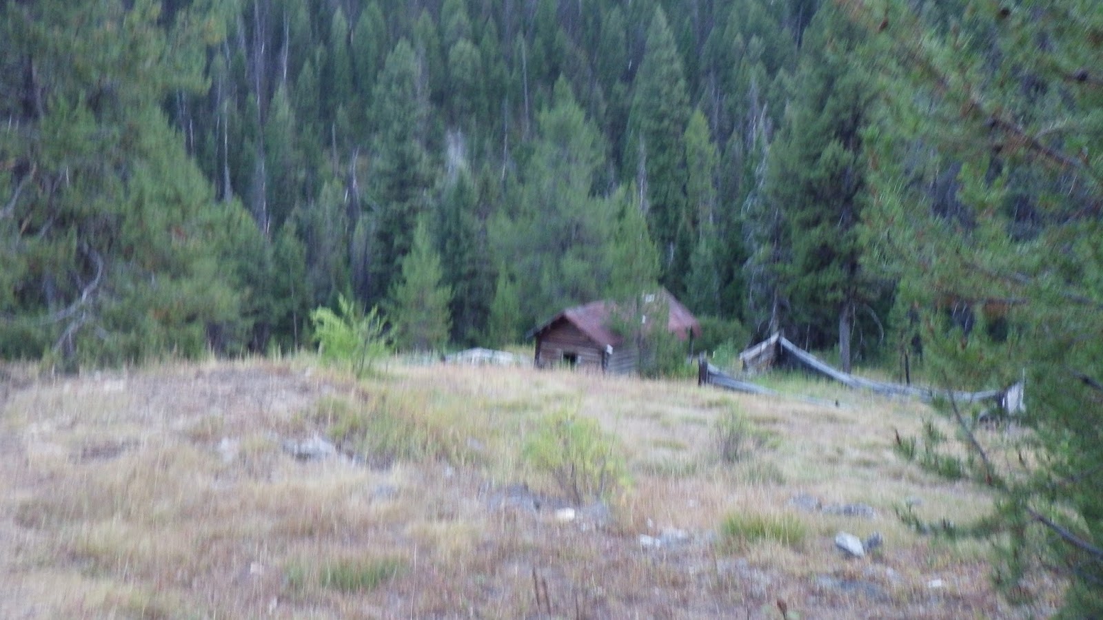
There was an old mine on the road and I started to see structures through the trees as I made my way down. Old cabins, in various states of disrepair. I wanted to go and explore them, but I didn’t know if they might be occupied or private property. Plus, I was in a tiny bit of a hurry.
I did take pictures of most every building I saw.
Although the road on the map did not divide or deviate, I ran into intersections. Some of them were like driveways, and I knew not to take those, but others were more like roads of their own. I chose the roads based on what I considered logical at the time, and I dragged my trekking poles in the gravel to show Ambrose where I had walked.
I did consider stopping to wait for him, because technically it was a junction and I wait at junctions for my hiking partner.
But I hiked on. Because I would serve my hiking partner better in this case by getting to the car and driving it back to him. I trusted that he would follow my scrape lines in the gravel and not get too lost. I made sure they were really long and big, as obvious as possible.
I crossed little streams that crossed the road and took pictures near the mine. Of course, the pictures weren’t always the best because I was not interested in moving slowly. I would stop, snap, and if the picture was blurry, oh well, I could get one next time.
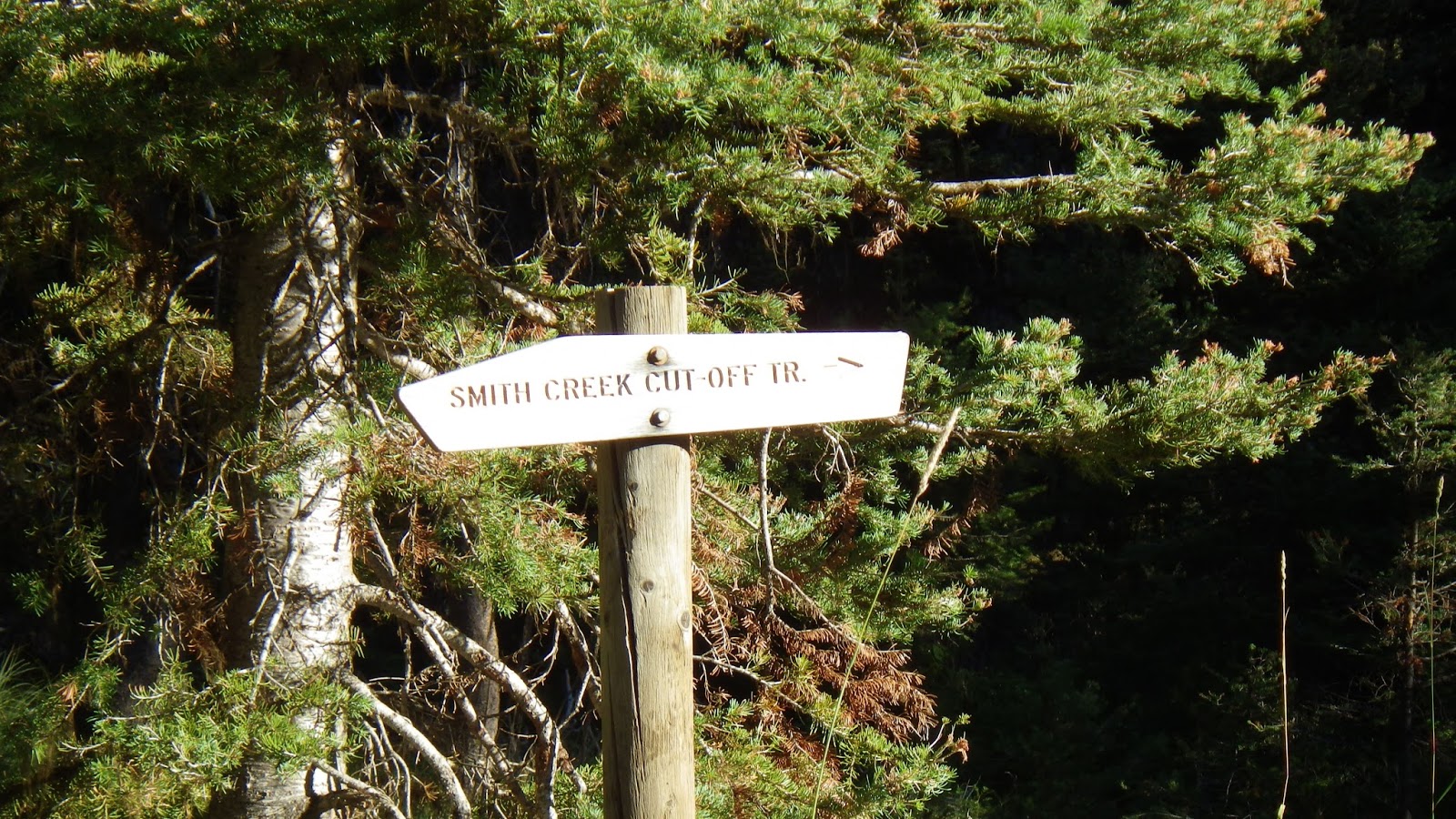
As I passed the last house like structure off the road, I saw a sign for the Smith Creek Cut-Off Trail. Logically, I thought, this would be something that I could hike and avoid the long detour that cars had to take staying on the jeep road. I knew from the map that I would be hiking far away from my destination only to double back once I reached the main road off the creek. But I didn’t want to explore an unknown trail by myself. I stayed on the road and wondered if Ambrose would try the cut-off.
My resolve was immediately challenged, because the road crossed another body of water and then went uphill. I really felt that the road should be going downhill all the way, but according to the GPS, this was not an unexpected thing. I made my way up the hill and decided I’d turn right around if it didn’t turn back downhill right quick.
It took a little longer than I wanted, but the road did trend down again, and turn west. The sun was low enough by now that I didn’t have any in my eyes as I made my way to the junction.
The junction was not what I expected. I thought I’d see a main road going west and east; instead, to the west the road was ATV only and to the east it wasn’t much better. The wear on the gravel and dirt of the road showed that more vehicles went up the jeep road than down the ATV section. Or they turned around using the jeep road. One or the other.
I sat down and took a break. It was almost 7. The sun would set before 9. I had 3 to 4 miles to go to the car. So I didn’t take a long break. And (much to Ambrose’s later disappointment) I didn’t take another GPS fix for the rest of my hike. I stuffed some gorp in my mouth and looked at the junction, hoping to see signs of people, perhaps friendly people, riding ATVs and willing to wait for Ambrose to get down and give him a ride back to the car.
Such people did not materialize in the few minutes that I sat on the side of the road. In fact, no one materialized. I stood and set to walking.
I figured that I’d need at least 90 minutes to get to the car. I can do a 20 minute mile, but I had a heavy pack and it had been a long day. I wasn’t anticipating making that pace with my current state of footsore tiredness. Knowing that I could maintain a pace of 30 minute miles helped me focus through the pain in my feet. I kept my head down a lot while I walked.
But there was still a lot to see, even without looking too closely at the ridgelines around me. I could see the road ahead of me, gently rolling. The trees and brush forming green canyon walls on either side. The murmur and splash of Smith Creek. A sidestream incongruously crossing the road just before a newly constructed bridge.
I saw a camping spot for horse parties, complete with hitching posts, and another sign for the Smith Creek Cut-Off Trail. I kept an eye out for places to turn the car around when I drove it down to get Ambrose. I also looked at the road itself, eyeing places that our Ford Focus might not get past. When I saw those I tried to re-calibrate how far down the road I could come to get Ambrose.
I re-calibrated a lot. Especially when the road was no longer hard packed dirt, but loose dust that buried my boots a few inches and floated around me in clouds with every step. I began to worry about driving that road in the dark.
I limited my water intake to make sure that I had enough to get me to the car. I only drank every 30 minutes. It gave me something to look forward to.
When I saw an old cabin slowly returning to nature, I had to stop and take pictures, but I lost some to my haste. I wanted to look at them more closely, to examine their interiors and see what I could see. But I wanted more to get to the car before dark.
After 8, I passed a road that helped me place myself. There was a smell of a campfire or wood stove down the road, but I didn’t head down it. I didn’t know if it was private property or a campsite or what. And I was getting closer to the car. I starting noticing the ridgeline coming down on my right and hoped that it was the one near the car.
More old structures got a few quick photos, but I was motivated now. I had to be close. Seeing the trailhead where Ambrose and I had set off was almost anticlimactic. Just one more hill - which was a lot steeper than I remembered - and there. The car! A toilet! Before 8:30!
I went to the toilet first. Then the car where I changed into dry, clean clothes.
The effects of hiking with little water and little food caught up to me. I sat in the driver’s seat of the car, ate handfuls of gorp, drank a coconut water and took about 20 minutes to rest. And then I started the car and began my rescue ranger mission.
I drove slowly down that steep, curving hill to the trailhead.
And I hit a rock. I couldn’t get past it, so I backed up a bit and tried a different trajectory down the hill. Unfortunately, the road was so narrow, there weren’t that many trajectories to choose from. I hit a rock again, possibly the same rock, and felt the beginnings of panic.
The last thing I wanted to do was break the car out here, miles and miles from where we could get it serviced. And so I made a tough decision. I would turn back. Ambrose would have to walk himself out.
I backed up the hill, not without a few more moments of panic as I failed to fully account for the curvature of the road in my uphill reversal. But I made it. And I parked on the opposite side of the road from where we had been parked, because it was closer to the toilet and grassier.
I got to work so I wouldn’t have to think too much about leaving Ambrose to his own devices.
I pitched the car camping tent right next to the car. I inflated our car camping air mattresses and laid out the down comforter. Darkness fell.
I took a coconut water down the trail and sat at the trailhead. My headlamp batteries were running low, and I had somehow managed to forget to refill my spares, so I sat in the darkness before moonrise, listening to the water of the creek rush by, the wind rustling the branches of the trees and strained my dark adapted eyes for signs of Ambrose’s headlamp.
When I grew too cold, I set the coconut water on a wooden post near the trailhead and went back to the car. I wrote my fiction and read my books. I tried to keep my mind from imagining worst case scenarios.
Around 10 I decided I should cook dinner. I made a rice a roni type thing with tuna added using the Coleman stove set on the grassy gravel of the parking lot. Focusing on cooking helped me not to worry as much, but I was worried. I wondered if Ambrose might decide it would be better to stay the night somewhere along the road.
I ate as much as I could force myself to. I knew I was hungry, but my nerves made my appetite disappear. I set the pot on the passenger’s seat in the car when I had eaten all I could. It might still be warm when Ambrose arrived.
When the moon rose, I took handfuls of dark gravel from a pile near where we had been parked and made an arrow across the road to point Ambrose to the car. It showed up pretty well on the light gravel of the road even in the moonlight. With a headlamp on it, the sign was very clear.
I finished one book and started another. At nearly 1 in the morning, I decided I needed to try and sleep. If I was going to have to hike out in the morning to find my husband, then I needed to get some rest myself. I went to the tent and changed into long underwear for sleeping. I had accidentally left the car light on, but it helped me see, even through the tent wall.
And then I saw that there was another light.
Ambrose’s headlamp.
I scrambled out of the tent and did my best to help him. From when we started in the morning to the moment he arrived was almost 18 hours; the last 6 hours with no breaks and no food. He'd run out of water more than 2 hours before he got to the car. I gave him a coconut water and settled him into the driver’s seat. I took his boots off his feet and got him his sandals. I got him into the tent, got food into him, warmed him up under the down comforter and nagged him about drinking more when he started to shiver, just a bit.
I have never been so relieved to see him before in my life.
 |
| Ambrose had to come down from there eventually. |
He came around the corner and kept walking on while I scrambled to get my boots back on and my pack situated. I couldn’t blame him for moving on; there was no water here. So we hiked down the jeep road. It was definitely not a road our car could handle, but that wasn’t the plan.
I passed Ambrose quickly, but stopped soon after that because I saw a campsite and heard water. I dumped my pack and found that there was indeed accessible water and quite a nice little campsite set up. I got out the pot and my water bags to start filtration. Ambrose caught up and took a seat on a convenient log.
 |
| Behind Ambrose on the jeep road. |
 |
| A nice little camping clearing, with accessible water just across the road. |
Worst case, he’d have a long hike.
He insisted that I drink a pint of coconut water before I left him. I felt so optimistic that I would be able to bring the car to him. I’d be the rescue ranger hero of the day. All I had to do was move my feet as fast as possible.
Just before I left, he asked if I wanted to camp there. I almost said yes. It was after 6 in the evening and we were at a lovely little campsite with easy water access. We could easily spend the night and finish the last of the hike in the morning. But the siren song of the car was calling me. There was coconut water there, not powdered, but cool and fresh. A big tent, a cushy sleeping pad and clean clothes…
I headed down the jeep road as Ambrose continued to filter water into his bladder. I was going with what I had because I figured I’d have plenty to get back to the car at my zoom speed. I felt a tug in my heart as I left him behind. I had to trust that he would be able to get himself at least down to the road, and, possibly, all the way back to where the car was parked, without me there to chivy him along and keep his spirits up.
 |
| Clearly, the jeep road was being maintained. |
 |
| I could still see the sun through the trees, but it was inexorably setting. |
 |
| Muddy water on the road. |
Every time I stopped to take a picture, I was conscious of the angle of the sun. Most of the time, I couldn’t see the sun because of my position snugged up against a westerly ridge, but when the road turned I could see it starting to turn the golden of pre-dusk. I had studied the map, but I was mostly relying on the GPS at this point, because I figured my map case would slow me down. I had actually stowed the map case - I know now I should have left Ambrose the maps, since I had the GPS, but I didn’t.
 |
| It looks like it could be lived in, if not currently occupied. |
 |
| I think that log on the left is supposed to be a "bridge." |
I did take pictures of most every building I saw.
 |
| Another fairly intact structure. |
 |
| This one looks like nature has defeated it. |
 |
| The sun's still shining. For now. |
 |
| Nature wins again. |
 |
| The largest structure I saw. It was near a road leading off the to the left, possibly a driveway. |
But I hiked on. Because I would serve my hiking partner better in this case by getting to the car and driving it back to him. I trusted that he would follow my scrape lines in the gravel and not get too lost. I made sure they were really long and big, as obvious as possible.
I crossed little streams that crossed the road and took pictures near the mine. Of course, the pictures weren’t always the best because I was not interested in moving slowly. I would stop, snap, and if the picture was blurry, oh well, I could get one next time.
As I passed the last house like structure off the road, I saw a sign for the Smith Creek Cut-Off Trail. Logically, I thought, this would be something that I could hike and avoid the long detour that cars had to take staying on the jeep road. I knew from the map that I would be hiking far away from my destination only to double back once I reached the main road off the creek. But I didn’t want to explore an unknown trail by myself. I stayed on the road and wondered if Ambrose would try the cut-off.
 |
| If I had been hiking with Ambrose, we probably would have chanced it. |
 |
| Why is the trail going up? |
 |
| Okay, good, it's heading down again. |
The junction was not what I expected. I thought I’d see a main road going west and east; instead, to the west the road was ATV only and to the east it wasn’t much better. The wear on the gravel and dirt of the road showed that more vehicles went up the jeep road than down the ATV section. Or they turned around using the jeep road. One or the other.
 |
| Almost there. I've got to be almost there. |
 |
| This is not the junction I thought I was looking for... |
 |
| Maybe an ATV will come roaring up the ATV trail and give me a ride? |
Such people did not materialize in the few minutes that I sat on the side of the road. In fact, no one materialized. I stood and set to walking.
I figured that I’d need at least 90 minutes to get to the car. I can do a 20 minute mile, but I had a heavy pack and it had been a long day. I wasn’t anticipating making that pace with my current state of footsore tiredness. Knowing that I could maintain a pace of 30 minute miles helped me focus through the pain in my feet. I kept my head down a lot while I walked.
But there was still a lot to see, even without looking too closely at the ridgelines around me. I could see the road ahead of me, gently rolling. The trees and brush forming green canyon walls on either side. The murmur and splash of Smith Creek. A sidestream incongruously crossing the road just before a newly constructed bridge.
 |
| Head down hiking time down the road. |
 |
| Water before a bridge. |
 |
| A nice, new bridge on the road. |
 |
| Hitching post at a horse camping spot. |
 |
| I should have taken the cutoff trail! |
I limited my water intake to make sure that I had enough to get me to the car. I only drank every 30 minutes. It gave me something to look forward to.
When I saw an old cabin slowly returning to nature, I had to stop and take pictures, but I lost some to my haste. I wanted to look at them more closely, to examine their interiors and see what I could see. But I wanted more to get to the car before dark.
 |
| The golden light of sunset paints the tops of the trees. |
 |
| The road just keeps going, and going, and going. |
 |
| Nature always wins. |
 |
| But there's still a door frame here, a discernible structure through the ravages of time. |
 |
| The side road helped me place myself on the GPS in better context. |
 |
| That house looks like it could still be in use. Maybe. |
 |
| Why is this road still going??? |
 |
| Oh! Oh! Oh! I remember this part! |
 |
| Just one more hill to the car. One. More. Hill. |
 |
| What a beautiful sight! |
 |
| At last! The car! |
I drove slowly down that steep, curving hill to the trailhead.
And I hit a rock. I couldn’t get past it, so I backed up a bit and tried a different trajectory down the hill. Unfortunately, the road was so narrow, there weren’t that many trajectories to choose from. I hit a rock again, possibly the same rock, and felt the beginnings of panic.
The last thing I wanted to do was break the car out here, miles and miles from where we could get it serviced. And so I made a tough decision. I would turn back. Ambrose would have to walk himself out.
I backed up the hill, not without a few more moments of panic as I failed to fully account for the curvature of the road in my uphill reversal. But I made it. And I parked on the opposite side of the road from where we had been parked, because it was closer to the toilet and grassier.
I got to work so I wouldn’t have to think too much about leaving Ambrose to his own devices.
I pitched the car camping tent right next to the car. I inflated our car camping air mattresses and laid out the down comforter. Darkness fell.
I took a coconut water down the trail and sat at the trailhead. My headlamp batteries were running low, and I had somehow managed to forget to refill my spares, so I sat in the darkness before moonrise, listening to the water of the creek rush by, the wind rustling the branches of the trees and strained my dark adapted eyes for signs of Ambrose’s headlamp.
When I grew too cold, I set the coconut water on a wooden post near the trailhead and went back to the car. I wrote my fiction and read my books. I tried to keep my mind from imagining worst case scenarios.
Around 10 I decided I should cook dinner. I made a rice a roni type thing with tuna added using the Coleman stove set on the grassy gravel of the parking lot. Focusing on cooking helped me not to worry as much, but I was worried. I wondered if Ambrose might decide it would be better to stay the night somewhere along the road.
I ate as much as I could force myself to. I knew I was hungry, but my nerves made my appetite disappear. I set the pot on the passenger’s seat in the car when I had eaten all I could. It might still be warm when Ambrose arrived.
When the moon rose, I took handfuls of dark gravel from a pile near where we had been parked and made an arrow across the road to point Ambrose to the car. It showed up pretty well on the light gravel of the road even in the moonlight. With a headlamp on it, the sign was very clear.
I finished one book and started another. At nearly 1 in the morning, I decided I needed to try and sleep. If I was going to have to hike out in the morning to find my husband, then I needed to get some rest myself. I went to the tent and changed into long underwear for sleeping. I had accidentally left the car light on, but it helped me see, even through the tent wall.
And then I saw that there was another light.
Ambrose’s headlamp.
I scrambled out of the tent and did my best to help him. From when we started in the morning to the moment he arrived was almost 18 hours; the last 6 hours with no breaks and no food. He'd run out of water more than 2 hours before he got to the car. I gave him a coconut water and settled him into the driver’s seat. I took his boots off his feet and got him his sandals. I got him into the tent, got food into him, warmed him up under the down comforter and nagged him about drinking more when he started to shiver, just a bit.
I have never been so relieved to see him before in my life.
Wednesday, November 2, 2016
Chamberlain Basin August 2016 - Day 6 Part 1
We had enough food to stay out for one more day, but Ambrose wanted to get out today. To reach the car and drink some of the coconut water we had stashed in the trunk. To finish up our first Chamberlain Basin trip and have an extra day to recover at home. Oh, and also to eat a hot breakfast in Yellow Pine.
So we woke up and got moving with the plan of reaching the car motivating us.
We started on the trail just before 7 in the morning. According to the guidebook, the next good water was a pair of springs a half mile before the Mosquito Springs hunting camp cut off. But we didn’t know how far it was from Chicken Spring to those unnamed ones. We did see the trail that was supposed to be near Chicken Spring as we hiked towards the sunrise.
The trail led up and we crossed a saddle to the east side of the ridge. There, we hiked up some switchbacks in the morning light. I was glad as I climbed that we hadn’t tried to press on the night before. Maybe we could have kept going if we’d paused to eat dinner, but it would have been a dark and scary hike.
And when I reached the top of another saddle, I didn’t see any water. I thought it would be close to Chicken Spring, but no. And it was 40 minutes from our campsite so, again, good thing we didn’t push on yesterday.
I waited for Ambrose to catch up and take care of some business. Then I started my zoom-pause cycle again. I wasn’t setting the time, because we were planning on stopping at the next water on the trail.
I hiked down and hated it, because I knew we would have to regain all that elevation and more before we topped out for the day. But again, the scenery was too beautiful to hold onto any negative emotions.
I’d been hoping that the next spring would be better than Chicken Spring, and Ambrose was hoping for that as well, because we made the decision not to refill our bladders until we reached that next spring. Unfortunately, this spring was nearly stagnant, muddy bottomed and full of debris. I’m a pretty smooth scooper when it comes to getting water out of streams and pools, but I couldn’t even get a cup of water without dead bugs and leaves in it. I was so distracted by our water situation that I never even took any pictures of the so-called springs.
Now, our filters are pretty good, but they aren’t perfect. They aren’t going to turn mud into water. They got slow as we tried to refill our bladders.
And then we decided that it was time to try something else. I used a bandana to pre-filter the dirty water into one of our nalgene bottles, and then poured the debris free water into a water bag. Ambrose was in charge of filling the bladders from the water bag. And with that innovation, the filtering went a lot faster.
It took a long time to filter our water, partly because Ambrose also insisted that we drink some coconut water from the clean nalgene bottle. And partly because of that whole slow filtering thing. The springs on this trip have not lived up to my expectations - but water is water. We needed it.
I went back to timing 50 minute intervals for our hiking, but I stayed pretty close to Ambrose at first because there were several junctions that I stopped at to wait for him. There were also some great views just off the trail that I explored because my feet were doing pretty well. Usually, my feet just hurt every day within hours of starting my hiking day, but my new boots seemed to be doing the trick. They were sore, but not so sore that I didn’t feel like I could “waste” steps just for scenery.
According to the guidebook, we would round a corner, cross a saddle and then start switchbacking up. I rounded the corner all right, and there was definitely a saddle, but the trail just went up. It was steep, but not switchbacked. Even with the GPS defining our location according to satellites, I wasn’t comfortable not having the paper topo map. It would probably have been better if the trail was on the GPS, but it wasn’t. I was still carrying the device, because I knew that Ambrose would have to keep moving steadily if we wanted to reach the car that day.
We did reach the switchbacks after crossing another saddle. The trail stayed mostly on the west side of Mosquito Ridge, but as we got higher, there were times that we were on top of the ridge and able to see to either side. The trail was headed up again, but not switchbacking.
I knew that we had to get to the high point of the day, nearly 9000 feet before we would be back on the maps I was carrying, and I had that ambivalent feeling about reaching it. The closer we got to that point, the sooner we’d be getting to the car, leaving the wilderness, ending this great adventure.
There were places where you could see that the trail used to be a road. It was wide and had clear wheel ruts in the dirt. But most of the trail wasn’t like that. It had been reconfigured not to accommodate vehicles, to keep the trail only for feet.
To the east, I saw the glint of water far below. The green meadow in which it resided was probably too boggy for camping, but I still thought about exploring it some day. Going off trail to reach places that even the small minority of people who come into this wilderness have not all been.
I missed my topo map as we continued to traverse the ridgeline. I could see distinctive features to the south and west, but I didn’t have the map to compare them to. Sure, the GPS could tell me some things, but I wanted the topo. I wanted to be able to practice my map skills with these features. I felt confident that I would have been able to find that right angled ridge on the map if only I had had it. Of course, we were by now on the map that I had actually decided to leave at home because we were only going to be on it for a couple miles.
I could feel the high saddle was approaching by the increase in the wind on my face. It didn’t look very special when I got there, but I knew it was the highest point of our day. The last true uphill until we crossed the Smith Creek bridge just before the car’s parking lot.
I stopped for lunch in the shade of a tree close to a rock. I leaned against my pack, took my boots and socks off and propped my feet on the rock while I read and ate. Ambrose joined me eventually and also ate lunch. It was a good thing we were down to just bars for lunch because there was no water to make anything dehydrated.
We talked about our plans for the rest of the day. According to the guidebook, we had some switchbacks down to a saddle, and then 21 switchbacks down to the jeep road. From the jeep road, another couple miles down to Smith Creek Road and three or four miles to the parking lot from there. We decided that once we reached the jeep road, I should go ahead as fast as I could and get to the car. Then, I should try and drive the car as far as I could to pick Ambrose up.
This was going to be a gamble, because the chances that I could get our Ford Focus down that road at all weren’t great. But we both felt it was worth a try.
As we hiked down the first set of switchbacks, there was clear evidence of recent trail maintenance. I fantasized about finding an ATV on the jeep road with people who would be willing to give Ambrose a ride back to the car. And maybe give me a beer. I’d find them first, of course, and ask them to wait for Ambrose because he needed a ride more than I did. It was a pleasant thought.
I was ahead of Ambrose at the next saddle, and I had to answer a call of nature. I made sure to leave my pack visibly on the trail and found my place for business with a wonderful view to the north. According to the guidebook, I should be able to see the Sheepeater Mountain Lookout from here, but either it was too hazy or I wasn’t looking in the right place. I didn’t see any sign of the lookout, but it didn’t matter. What I did see was gorgeous enough.
I got back to the trail and wasn’t sure if Ambrose had passed me or not for a moment. Then I saw that he had courteously watered the trail to let me know he was now ahead.
At the next switchback I started counting. I was back on the topo map, but it’s not easy to count switchbacks on the map because they tend to be a series of squiggles. I put my faith in the guidebook this time and promised myself a nice long break at the jeep road.
I stopped at the next 50 minute mark in the shade of a tree on the 6th switchback. I leaned on a log after I carefully examined it for ants and waited for Ambrose to catch up. He looked tired to me, but willing and able to keep going. We were both sweaty and dirty, but it felt like we were almost there. The counting really helped to keep my spirits up.
It seemed like the odd numbered switchbacks were shorter than the even ones, but I’m pretty sure I kept accurate count and there were actually 22 switchbacks before I reached the jeep road.
I felt like I’d won a prize when I reached the jeep road. There were signs and I could hear water, though there was no way to reach it from that point on the road (I did check). So I settled down in some grass and waited for Ambrose to catch up.
To be continued...
So we woke up and got moving with the plan of reaching the car motivating us.
 |
| Ambrose took a picture of our precariously pitched tent. |
 |
| Yes, this really isn't an ideal place to pitch a tent. |
 |
| Based on the guidebook, I thought this junction would be closer to Chicken Spring. |
 |
| One last look at the western valley below Chicken Peak. |
 |
| The sun on the saddle. |
 |
| The trail wasted no time in heading up. |
I waited for Ambrose to catch up and take care of some business. Then I started my zoom-pause cycle again. I wasn’t setting the time, because we were planning on stopping at the next water on the trail.
 |
| Everything was so green, but there was no water up here. |
 |
| Looking back down at Ambrose from a switchback. |
 |
| This would be a really nice place to camp if it had a water source. |
I’d been hoping that the next spring would be better than Chicken Spring, and Ambrose was hoping for that as well, because we made the decision not to refill our bladders until we reached that next spring. Unfortunately, this spring was nearly stagnant, muddy bottomed and full of debris. I’m a pretty smooth scooper when it comes to getting water out of streams and pools, but I couldn’t even get a cup of water without dead bugs and leaves in it. I was so distracted by our water situation that I never even took any pictures of the so-called springs.
 |
| The trail soon before the springs. |
And then we decided that it was time to try something else. I used a bandana to pre-filter the dirty water into one of our nalgene bottles, and then poured the debris free water into a water bag. Ambrose was in charge of filling the bladders from the water bag. And with that innovation, the filtering went a lot faster.
It took a long time to filter our water, partly because Ambrose also insisted that we drink some coconut water from the clean nalgene bottle. And partly because of that whole slow filtering thing. The springs on this trip have not lived up to my expectations - but water is water. We needed it.
I went back to timing 50 minute intervals for our hiking, but I stayed pretty close to Ambrose at first because there were several junctions that I stopped at to wait for him. There were also some great views just off the trail that I explored because my feet were doing pretty well. Usually, my feet just hurt every day within hours of starting my hiking day, but my new boots seemed to be doing the trick. They were sore, but not so sore that I didn’t feel like I could “waste” steps just for scenery.
 |
| So much to look at! |
 |
| Even though some trees were burned and dead, the scenery was still amazing to me. The new growth and the old together. |
 |
| Had to stop here - no passing junctions without your partner! |
We did reach the switchbacks after crossing another saddle. The trail stayed mostly on the west side of Mosquito Ridge, but as we got higher, there were times that we were on top of the ridge and able to see to either side. The trail was headed up again, but not switchbacking.
 |
| Another junction. Was it on the map? I didn't know. |
 |
| Heading up through evergreens and old snags. |
 |
| Portrait of a bird. |
 |
| I wished for a little less haze in the distance, but enjoyed the views nonetheless. |
 |
| More uphills on the way. |
 |
| Oh, to explore those valleys and mountains. |
To the east, I saw the glint of water far below. The green meadow in which it resided was probably too boggy for camping, but I still thought about exploring it some day. Going off trail to reach places that even the small minority of people who come into this wilderness have not all been.
 |
| I caught that wheeling bird with a great deal of luck. |
 |
| We weren't topped out yet. |
 |
| The meadow looked perfect from above, but was probably boggy. |
 |
| Still going up. |
 |
| Double track, as if wheeled vehicles had come this way. |
 |
| One last false junction before the top out. |
 |
| We just had to keep heading up a little while longer. |
I stopped for lunch in the shade of a tree close to a rock. I leaned against my pack, took my boots and socks off and propped my feet on the rock while I read and ate. Ambrose joined me eventually and also ate lunch. It was a good thing we were down to just bars for lunch because there was no water to make anything dehydrated.
 |
| With a topo map, I would have had a chance to identify these mountains and that long ridge. |
 |
| Soon, I'd leave this western view behind. |
 |
| A particularly witchy snag caught my fancy. |
 |
| Just about at the saddle. |
This was going to be a gamble, because the chances that I could get our Ford Focus down that road at all weren’t great. But we both felt it was worth a try.
As we hiked down the first set of switchbacks, there was clear evidence of recent trail maintenance. I fantasized about finding an ATV on the jeep road with people who would be willing to give Ambrose a ride back to the car. And maybe give me a beer. I’d find them first, of course, and ask them to wait for Ambrose because he needed a ride more than I did. It was a pleasant thought.
I was ahead of Ambrose at the next saddle, and I had to answer a call of nature. I made sure to leave my pack visibly on the trail and found my place for business with a wonderful view to the north. According to the guidebook, I should be able to see the Sheepeater Mountain Lookout from here, but either it was too hazy or I wasn’t looking in the right place. I didn’t see any sign of the lookout, but it didn’t matter. What I did see was gorgeous enough.
 |
| No Lookout, but plenty to see. |
At the next switchback I started counting. I was back on the topo map, but it’s not easy to count switchbacks on the map because they tend to be a series of squiggles. I put my faith in the guidebook this time and promised myself a nice long break at the jeep road.
I stopped at the next 50 minute mark in the shade of a tree on the 6th switchback. I leaned on a log after I carefully examined it for ants and waited for Ambrose to catch up. He looked tired to me, but willing and able to keep going. We were both sweaty and dirty, but it felt like we were almost there. The counting really helped to keep my spirits up.
 |
| A switchback and a northern view. |
 |
| The southern view. |
 |
| A different kind of a view when the trees are alive. |
 |
| Switchbacking down to the jeep road. |
 |
| Ah, a nice patch of grass in the shade to the right. |
 |
| Leaving the wilderness. |
 |
| The Mosquito Ridge sign pointing back the way I came. |
Subscribe to:
Posts (Atom)