Wednesday, August 28, 2019

Queens River Loop August 2019 - Day 2


Ambrose insisted that we get up early on this trip. I held him to it this morning, which dawned with only some clouds.

Scott Creek was a bit of a challenge to cross.

The clouds began to descend.

Ambrose wanted to stop and bivy after we crossed this creek. I went through without taking my shoes off and got all wet.

The clouds didn't care about how wet my feet were.

Ambrose ended up getting his feet wet in this creek, too. As usual.

But soon after the crossing, I spotted this campsite. And we stopped here for a couple hours, pitching the tent and getting everything out. But my feet never warmed up and we moved on - and it never even rained.

The sun started to come out, and I began to thaw out a bit.

But there was another crossing to wet my feet again. 

And then plenty of downed trees to climb over, crawl under or bypass.

We made it to the Neinmeyer junction, but later than I'd hoped.

Still some wildflowers blooming on the trail.

No deer in the tarn this time.

I hiked on by the junction for Scenic Lake ahead of Ambrose so he wouldn't be tempted to stop there for the night.

But I wanted to get up there.

I tried to avoid stepping in the water to keep my feet dry. The day was still pretty cool even with the sun shining.

But we were going to get up there. Somehow, I was going to get us up there.

Even if Ambrose would rather have sat down and taken a nap.

He wanted to camp at the base of the section of the trail that we call the ramp. But I couldn't find a suitable spot to pitch the tent. So he sat and ate while I scouted. And then he recovered enough to go on - but only to the top of  the ramp. 

I went ahead to the top of the ramp to find us a campsite for the night.

It really doesn't take that long. It's steep, but short. 

And the trail has had some improvement since I last saw it. This bridge over the stream was totally new.

And what used to be a decent flow of water was now a trickle.

We camped near the Browns Lake junction. And Ambrose was beat. I wasn't feeling so great myself, but I got to pitch the tent and fetch water - which I did at the Little Queens rather than the trickling stream. We gave some advice to passing hikers headed to Browns Lake after dinner. And then we slept, with a plan to head to Johnson Lake in the morning.

Wednesday, August 21, 2019

Queens River Loop August 2019 - Day 1

Ambrose and I drove out to the Queens River trail head on Saturday morning, arriving around 11 am. The plan was just to hike out a little bit, past the first crossing of the Little Queens River, but no more than that, even if we had time. This trip was all about being leisurely, taking 8 days to do a route that we knew we could do in 4.


Ambrose, ready to hit the trail.

He's even hiking ahead of me! (This did not last.)

I'm glad the sign for the Queens River/Little Queens River has been restored.

Still quite a few downed trees in the first couple miles.

But I can't complain - the bridge is still standing, after all.

Cute little caterpillar!

What a tragedy - unripe thimble berries. 

But there were a few ripe ones :)

This stream crossing has changed a lot since we've been hiking out here.

More tree obstacles.

Gorgeous view of the Little Queens.

I held these stinging nettles to the side for Ambrose - with my trekking pole.

Another side stream crossing that has changed almost every year.

I saw a little snake! So cute snek!

The trail sign for when it turns to cross the bridge is now out of commission.

The log in the water really interfered with the ideal crossing line.

More tree puzzles.

Time to find a campsite.

Looks like some rule breakers have been here before, as evidenced by this really old fire ring.

My first pitch of our zpacks triplex tent. Not bad, if I do say so myself.

And it has a lot more room than our original tent - we didn't have to squish together. Instead, we squished together by choice.
We spent the rest of the afternoon hanging out in the roomy tent. When it got dark, Ambrose was already asleep, and I went ahead and tried to sleep as well. The next thing I knew, he was shaking me awake. When I pulled my buff off my eyes, I could see - even without my glasses - that the sky was bright with lightning. And I could feel the thunder rumbling in my bones, a constant background noise that made me hop out of the tent to take a nature break before the sky broke wide open.

I also took that time to tighten every line on the tent so that it would be ready to protect us from the storm that was surely coming, based on the light show. I was surprised that I managed to get back in the tent without getting wet. But it wasn't long after I got in that the heavens began to release, and the rain pitter-pattered down on our tent. I checked the near the foot and the head to make sure we weren't getting any leaks, and then fell back asleep.

According to Ambrose, I missed a skunk coming to check out our tent. Guess I can't really blame him for not waking me. Better I sleep through the visit than we startle the skunk into spraying...

Wednesday, August 14, 2019

The Magruder Corridor

After I decided to stop my Idaho Centennial Trail hike for the year, Ambrose and I decided to drive around to the place where he would have been picking me up. That way, when I do it next year, we will know exactly where to expect to meet instead of getting lost...

The only place to take a vehicle between the Frank Church River of No Return Wilderness and the Selway Bitterroot Wilderness is a road called the Magruder Corridor. It's a single lane dirt road that runs between wildernesses between Elk City, Idaho and Darby, MT. It's 101 miles that can take more than 8 hours to drive - if you have 4 wheel drive. Folks driving on it are advised to carry cutting tools, plenty of water, and a properly inflated spare tire. 

We drive a Ford Focus sedan. It really isn't meant to drive on that kind of road, but we were going to give it a go - only to Dry Saddle, where the Idaho Centennial Trail comes from the Frank Church and then follows the corridor for a spell before heading into the Selway. 

Caution signs at the start of the road - only 33 miles to Dry Saddle.

The road started off decently. 

We reached 14 mile campground in about an hour. 

The Elk Creek Road junction at the start of a large burned out area. 

The trees being burned did at least allow us some expansive views.

Poet Creek Campground where we took a little break. 

Graffiti on the inside of the privy at Poet Creek.

The road got rougher after this and I was too busy clenching and urging Ambrose and the car on safely to take many pictures.

Oh yeah, we got a Ford Focus up to Dry Saddle. And we didn't bottom out once!

What a gorgeous view of the wilderness, looking towards Montana.

We didn't see any Bigfeet or clowns.

The car is right in front of the trail head. I'll be either leaving from here or coming out here next year, depending on whether I decide to do the section southbound instead of northbound.

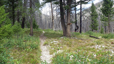
Ambrose and I hiked the trail out a bit to see what we could see. 

Ambrose on the trail.

Wilderness selfie! I borrowed Ambrose's hat because my hair was so short I could have gotten a scalp burn without it. 
Dry Saddle had a privy - but no toilet paper (we had some in the car though).


Hard to get a good picture from a moving car - even at slow speeds since there were a lot of bumps in the road.

A tease of a flat section before we re-entered the living forest and the one place where water crossed the road in a scary ditch.

It took us over 3 and a half hours to get up to Dry Saddle. We ate lunch there and hiked a bit before heading back down. Down wasn't any easier than up. We started up Magruder about 8 am and didn't get off it until 4 pm. A whole day to travel 66 miles.

Ambrose is a badass driver for making that happen in a stick shift sedan, but yeah... next time we head up there, it's going to be in a rental SUV :)