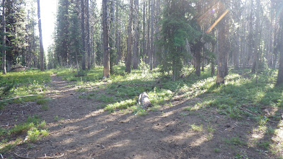
We had a bit of a disagreement as to how the day should go this morning. Well, the disagreement started the prior night, but continued on to the morning. Both Ambrose and I wanted to go, as planned, to Lower Ramey Meadows. Bill thought that we should heed the word of the horsepacker and go by way of Upper Ramey Meadows instead, since the trail to Lower was supposed to be no longer maintained.
But we all agreed that we should go and check out Rock Rabbit Point, as long as the trail wasn't too horrendous to get there.
So we set out, taking the trail the horsepacker had taken to exit. It rejoined the main trail at a familiar junction. Last year, I thought this trail was the start of the old one going down to Beaver Creek, but nope, it leads to the spring. A very steep trail, so I got warm pretty quick.
Then we had a nice morning ridge walk, through some recovering burned areas and some places that still had trees to shade us from the rising sun's rays. This part of the trail was familiar to me, so I was prepared when the ridge had a few climbs, and when the trail went over to the east side of the ridge, I knew to start looking for a right angle turn.
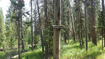
Bill and I were walking ahead of Ambrose and reached the sign for Lower Ramey Meadows. I, of course, took the sign to be an indication that said trail was still there. But Bill still had his doubts. We rested until Ambrose arrived and then there was some dithering about whether we should go on. I insisted that we all wanted to check out Rock Rabbit, so let's go. And I walked off. I was feeling a bit snitty.
And the trail got a bit rough, with lots of deadfall, and I waited for everyone to catch up and asked if they wanted to turn back. We all agreed to press on at least to the point.
I am so, so glad that we did.
I didn't know what to expect at Rock Rabbit Point, but I was not at all expecting a cabin. Not recently lived in, I'd say, with the broken window glass on the floor and some floorboards missing, but it's standing and has a door. There's also an old lookout tower that is barely standing and large piles of rocks.
No rabbits that I saw.
After gawking at the cabin and its environs, we kept going for a bit. The trail started easy and then got ridiculous with the amount of blowdown. For some reason, we all persisted past the worst of the blowdowns, and then I asked if everyone was comfortable going on. Bill volunteered that he was not, because Mike has a harder time navigating through rough trail.
But now Ambrose was set on going on. So we compromised. Bill would head back to the main trail with Mike and they would go through Upper Ramey Meadows and spend the night somewhere along there. We would meet up in the morning where the trail from Lower Ramey met up with the trail from Upper Ramey and then continue together.
I was quite satisfied with this solution, since Ambrose wasn't sure about making the extra distance going around to Upper Ramey would entail. And it meant that I got to have a bit of adventure alone with my husband.
Maybe a bit more than a bit of adventure...
The trail was decent for a while. And then we came upon a recently burned area. Recently enough that the ground was black ash, with very few sprouts of green growth. Trees were blackened and many had fallen. Blazes were not visible and neither was the trail. But we knew the direction we had to take. We persevered and regained the trail.
And again, it was good for a while. Some blowdowns, but nothing to write home about. We got pretty far, far enough to be thoroughly committed to our route before the trail completely disappeared.
We did not panic. We used our tools. First, map and compass, but the heading we got didn't feel right. So we pulled out the GPS and used it to navigate in the general direction of Lower Ramey Meadows. We weren't going to find the trail on this particular GPS model, but we could find the meadow. Not a direct route, because we detoured around a really thick section of young trees. And we actually ended up a bit too high in the wrong direction and had to come down into a kind of burnt bog.
And in this bog, in August, we stumbled upon a treasure hoard of morel mushrooms.
We have hunted for these little suckers in the "right" season (early spring), in the "right" places and never found more than a single mushroom at a time. And now, in the completely wrong season, in the middle of nowhere, we found this bounty. But we did forget to tag it on the GPS...
I harvested several mushrooms for Ambrose to carry and then we hiked on, soon reaching the meadow. It was such a wide, open space of green. Yellow also, because it was later in the season, but the colors were all fresh and right. Two cranes were startled by our arrival and flew off, honking at us in protest. We walked across the meadow, taking care not to step into a hidden stream, and came to rest under the shade of a couple of large pine trees.
We could have camped there. It was lovely. But I like to be prepared, and that meant finding the trail again before settling in for the night. We stumbled around a bit before I figured out a good tactic. Follow the water - the trail crossed Big Ramey Creek, and the GPS could show us that creek. So we just had to follow it up until we hit the trail. Easy.
The trail, however, wasn't the first indication that we were in the right place. No, that was Mike, running along and barking greeting on the far side of the creek.
Bill had decided to continue past Upper Ramey Meadows to the junction, and then explored and decided to cross the creek because he found a sign for Lower Ramey Meadows - and that's where he was camped.
Ambrose and I set up camp not too far from Bill and we got to the business of chores and relaxing and settling down for the evening. At one point, I thought I might need to dig a hole, so I took a walk. I found a little mini-meadow and walked into it to find a good spot. Instead, I found a grouse, just sitting on the ground, absolutely still. I left, because I didn't want to frighten it. And I didn't need to dig a hole anyway.
It was a pretty good place to camp, fairly flat and forested. But it was nothing like the meadow. There wasn't even a view of the meadow. And that was a bit disappointing.
 |
| Mike's ready to go and so is Ambrose. |
 |
| A bit of a climb to start the day. |
 |
| Ambrose in the lead - that didn't last long. |
 |
| Mike sometimes lets me lead. |
 |
| Regrowth after the burn. |
 |
| This part wasn't burned at all. |
 |
| Getting close to the junction. |
 |
| Ahhhhh! To the left, familiar, to the right, unknown. |
 |
| That's no rabbit! |
 |
| Lots of rocks though. And a cabin. Bill is in the foreground and Ambrose is farther back. Between them is the remnant of a fire watch tower. |
 |
| Oh sure, this trail's just fine. |
 |
| And check out these views! |
 |
| Well, okay, trail's a bit toasted here, but we're fine. |
 |
| See, back to trail. No problem. |
 |
| Um... also no trail. |
 |
| Yeah, this isn't trail either. |
 |
| Nope. Nope. Nope. |
 |
| We ate lunch somewhere around here. But it wasn't a good place to hike. |
 |
| Up here was easier, but also easier to get off track. |
 |
| The meadow is out there. Straight ahead? |
 |
| Morels! |
 |
| Lower Ramey Meadows. This hardly captures a fraction of how gorgeous this place is. |
 |
| Angry birds. |
 |
| Ambrose in the meadow. |
 |
| These grasses were chest high on me. |
 |
| And they concealed creeks, and creek beds, that would drop you down a couple feet if you stepped in them. |
 |
| This sign proclaims Lower Ramey Meadows, but it's nowhere near a view of the real thing. |


No comments:
Post a Comment