Showing posts with label Boise National Forest. Show all posts

Wednesday, October 12, 2022

Grouse Butte Training Hike

Between our Chamberlain trip, and my Idaho Centennial Trail trip, I wanted to get in one last training hike. I didn’t want to rest for all the weekends. Unfortunately, Ambrose wasn't feeling up to a hike, so a short backpacking trip was now out of the question. We had thought about a trip to Johnson Lake in the Queens River area. Ambrose was inclined not to go anywhere at all, but I insisted. I needed that last hike! 

I decided on a short but sweet little day hike in the Boise National Forest. We would drive to Willow Creek Transfer Camp and I would do a day hike up to Grouse Butte. Grouse Butte is almost on the Idaho Centennial Trail. When I did that section of the ICT, I thought about going up to the Butte, but decided against it. It was like an extra quarter mile and 300 feet elevation. But I always figured I’d come back some time and get to the top. I’m not a serious peak bagger, but I like to climb high points. 

I’d actually planned to hike up to Grouse Butte last year, but I wasn’t feeling great that day and I ended up stopping at the top of Virginia Gulch. I hoped that I wouldn’t encounter the same kind of issue, but it was also nice to know that I could get a good hike in even if I didn’t make it all the way up. After all, Virginia Gulch is like 2000 feet of gain in like two miles. It's a challenge. 

I took off from work early on Friday so we could drive out. It's a 3 to 4 hour drive, and we both wanted to get there well before dark to get the tent set up. Ambrose drove, and I finally got a picture of a weird house in Featherville that has a sign reading Qspot. I’ve been seeing it since 2020, but hadn’t managed to get a picture until now. 

When we got to the Willow Creek Transfer Camp, I was surprised. I had been there in late June, and it had undergone some changes. New rocks lined the road near the campsites, and there were no picnic tables. The Willow Creek site was still under construction, and I’m pretty sure they were using the tables from transfer camp down there for something. I hope the tables come back, but we made do without them. 

I got the tent set up, and we settled in for some relaxation time. 

The next morning, I got up early, got dressed and got in the car. Sure, I could have walked the mile or so to the trailhead, but Ambrose was able and willing to give me a ride. How could I possibly refuse? Especially since I asked. 

There was one vehicle at the trailhead already, and I wondered if I was going to catch someone or maybe cross paths as I hiked up. I’ve encountered hikers on this trail before, but not a lot. It’s a tough trail. I think more people go up on motorbikes than on foot. Ambrose parked the car, and we both got out. I got my pack on while Ambrose grabbed the camera to take some pictures of me. He got quite a few, though the lighting wasn’t great. He even caught me in the middle of regripping my trekking poles, and I can see my hands in the flicking position, just slightly blurred. 

I started hiking at about 6:40 in the morning. The sun wasn’t shining on me, but it was up enough to give me plenty of light to hike by. Not as much to take pictures by though. The light in the morning always gives me a bit of trouble with photos. I don’t like using the flash, because it tends to put too much light on foreground objects and completely lose detail in the background. With my point and shoot, I need to get good angles and hold the camera quite still to get decent morning light pictures. 

The start of the trail is a bridge over the Boise River. Ambrose took some pictures of me on the bridge, and then crossed with me. It was clear many motorbikes had been crossing the bridge from the tracks in the dirt. Also, and unfortunately, clear, was the pile of toilet paper behind a large tree trunk. It was as if someone asked themselves, what is the absolute least I could do to get rid of this toilet paper? Because the only way this would have been more disgusting was if it were literally in the middle of the trail. I mean, it was less than 3 feet from the trail, and not buried at all. Plus, they were probably no more than the length of the bridge from their car. Why could they not have just walked it to their car to properly dispose of it? Why leave it there? I just don’t get it. 

So that wasn’t the most pleasant way to start my morning, but I tried to let it go. I can’t make other people respect nature and our shared spaces. I can only try to provide the best example that I can with my own actions. 

The Virginia Gulch trail starts off kind of easy. It lulls one into a false sense of security. Sure, you’re hiking up this canyon, but it’s not that hard. Surely it won’t get any harder! Ha!

After maybe a quarter mile of relatively flat trail through nicely shaded woods, the trail begins climbing. Switchbacks start and they just don’t stop. The switchbacks bring elevation and views, but they also have a relentless elevation. Up, and up, and up. Then some more up. 

Having hiked this trail several times now, I was expecting the pain. And to be honest, it didn’t feel as hard as it had the last time. Maybe I was in a bit better shape this year than I had been in 2020. That would make sense, considering how messed up that summer season ended up being. But I’ve also found that familiarity with a trail tends to make it feel easier. 

It didn't seem to take long at all for me to reach the higher parts of the Gulch. There are some tremendous views, especially when the light is right. Today, I had threatening storm clouds massing in the distance, but no rain. And no one else on the trail. Which either means that whoever parked at the trailhead was walking along the river (there’s another trail that does that) or they were hiking so much faster than me that I couldn’t catch up. But the lack of foot prints made the former more likely. 

I felt pretty good when I reached the point where the trail crosses a road. It actually follows the road for a stretch, so I hoped I was remembering correctly to take a left. I walked for a bit farther than I expected, but I had indeed chosen the right direction. The trail veered up away from the road and I followed it up. This is where the hiking stops being so relentlessly uphill and starts rolling. Plus, the views began to include expansive views of the Sawtooth range. 

I don’t know exactly what it is about those views, but they fill my heart. They uplift my spirit. I try, again and again, to capture their essence in photographs, but I only get poor substitutes. Well, some of them are pretty nice photos, but they fall short. The best they can do is remind me of being there, which gives my spirit some secondhand lift. 

The combination of clouds and sunlight gilded the landscape even more impressively than usual. I probably could have stayed there a while, but I wanted to keep moving. Just because the hardest part of my hike was done didn’t mean my hike was done!

I took a break at the same spot I took a break the first time I hiked the trail, where a sign was posted on a tree, despite there not being any intersections at that spot. I also took that opportunity to go off trail and dig myself a hole. I was glad that I was able to wait until that point for hole digging, because the switchbacks don’t offer a lot in the way of off trail space. Up here, I can find a spot well off trail to do my business. 

Then I hiked on. The trail crosses a road, and then I came upon an intersection that I didn’t remember where the trail split. I decided to stick to the high road, just in case. I was pretty sure that was the route I’d taken last time. It brought me to another road crossing, and I could see where the low trail seemed to join back up right at the road. I figured I’d try that one on the way back, see how it was. 

Here, the trail becomes road. There’s a gate that allows the road to be closed off to vehicles. I think they close it in the winter, because the snow gets too high to safely drive. Oh, and in the spring, it keeps vehicles away from migrating animals. I do know the last time I was up this way, which was in early May of 2018, there was snow on the trail. If there’s snow in May, there’s definitely going to be a lot more snow in, say, January. 

Past the gate, the road wound on for longer than I remembered, with more uphill. And more switchbacks! But soon enough, I could see Grouse Butte up ahead, getting closer and closer with each step. I took another break along this stretch of road. I sat with my back against the embankment and watched as the line of sunshine crept from the edge of the road towards me. I ate a snack and enjoyed the incredible views. 

I was very excited to see the junction where the road I was currently walking on met up with the North Fork Lime Creek trail that I’d hiked before. When I hiked there in 2018, the entire junction was covered in snow. I had no idea what it really looked like. 

I suppose that excitement was why I found the sight a bit underwhelming. And it seemed like the signs must have changed, because I thought that the sign post was in a different position than it was before. Still, it was neat to see where the Lime Creek trail actually met the road – it was nowhere near where I had hiked over the snow. 

Then it was time to climb the butte, at long last. There’s not really a trail up to the top of Grouse Butte. There’s use trail, and maybe old trail, but nothing recently maintained. I remembered when I first saw it that there were tire tracks going up the butte, but I didn’t see any tracks now in the dirt. 

I did hear the roar of a motor in the distance, but I wasn’t going to stick around to find out if it was a motorcycle or an ATV. I had a butte to climb! 

After a short hike up, I found a sign marking Grouse Butte. The map has it at 6941 feet of elevation, but it’s got fairly good prominence. To the north, the sprawling giants of the Sawtooths dominated the view, while to the south, rolling foothills gave way to green fields. The wind blew, and insects whirred, and I was delighted. 

As I hiked back down, I could see what looked like an old trail going up another butte right across from Grouse. I didn’t know a name for it, but I was out here to train. Why not climb another hill? When I got back to the junction, I could see there was a sign on that old trail. It stated that the route was closed to vehicles, but it wasn’t one of those “area closed behind this sign” signs. Since I’m not a vehicle, I decided to go on up. Especially because the motor I heard earlier was sounding closer, and I needed to dig a hole. What better place than up a hill where no one could see me? 

This butte had less of a top than Grouse. I’m not even sure it’s technically a butte, but I’m going to roll with that anyway. I wasn’t sure exactly where the high point was when I got up there, so I walked around a bit on the lumpy dirt interspersed with grasses and bushes. Then I caught sight of something weird, a shade of orange that I was not expecting to see. I mean, there are some orange flowers out there, but this orange was way too concentrated to be natural. 

I headed over to check it out and found a very strange sight. There were two shades of orange, and even some pink now that I was close. Most of the orange was like cellophane, broken and scattered over about a square yard. Then there were strings and balloon remnants, plus a white tag. At first, I thought it was a weather balloon. I’ve found those out in the woods before, and I think it’s really neat. But there was no box with instructions for return, just the tag that warned against touching if the balloon was still inflated, due to the dangers of explosive gas. 

At that point, I figured it must have been a part of fire retardant disbursement. I’m not sure that makes sense or not, but I couldn’t think of what other purpose sending a balloon like that out would be. Since I was on a day hike, I gathered up what I could (after taking pictures) and stuck it in my pack to take out to the trash. I wished I could take it all, but I wasn’t really equipped to hoover up cellophane from the dirt. I hoped that the cellophane was a modern biodegradable type; it was falling apart quite easily. 

Then I hiked back down to the junction. I had to step carefully, because the old road no longer resembled a good walking surface. I caught a glimpse of the motorcyclist I’d been hearing, but I’m pretty sure they didn’t see me. Then I started back down the road. Before I had time to get into my rhythm, I heard another motor coming. I stepped as far to the side of the road as I could, while also trying to be visible. Luckily, the driver of the ATV saw me and slowed to go around me. I exchanged smiles with the driver and passenger, and then kept on hiking. 

The clouds that had been threatening as I hiked got a bit more threatening as I descended towards the gate. I even felt a few raindrops. It was also time for lunch. When I got down to the junction below the gate, I picked a spot to sit and eat lunch that was sheltered by evergreens. I might get a little wet if the rain were to start in earnest, but I’d be well protected from sprinkles. I sat down to eat my lunch – a Sans bar. While I sat and ate, two ATVs came down the road. Both drivers looked like hunters, but only one of them noticed me. They drove off well before I finished eating, motor sounds echoing through the hills. 

When I was ready to move, the threat of rain had moved on. It still wasn’t sunny, but that’s not a bad thing when I’m hiking. I had a choice at this point – risk that the low trail would rejoin the high trail or just take the high trail again. 

I took the risk. 

It paid off. This trail was better maintained than the other one, and I wouldn’t be surprised if the high trail were closed the next time I got up there. The low trail stayed low longer, which made the climb to rejoin the high trail a bit steeper, but I liked it. 

I continued on the trail, crossing the road again and taking a break at the same spot by the sign that I had on the way up. I spotted a gnarly looking bit of junk on the dirt of the trail. It looked like a fistful of mucous, but it was a weird brownish color. I did take a picture, but I’m not going to post it. I wondered if it was some kind of afterbirth or maybe even part of some animal’s menstrual cycle. Personally, I found it fascinating, but I didn’t have time to linger and examine it more closely. 

The descent of Virginia Gulch is steep and pretty quick. By now, I have a good idea of the trail. I can tell when I’m getting close. But I fell prey to my overthinking. 

You see, throughout this hike, I had been using my InReach Mini to communicate my progress to Ambrose. We were using this trip to test how well the InReach to InReach communication worked since we'd be relying on that for my ICT trip later in the month. I’d sent him a message when I got out of the gulch, another at Grouse Butte. But the main thing was going to be sending him a message when I wanted to be picked up. It’s hard to judge how long it takes the messages to get through. We were hoping to figure out how long I might have to wait if I send him a message right when I need to get picked up. 

So I know I’m getting close to the bottom of the gulch, to the bridge where Ambrose will come and pick me up. I’m within an hour for sure, maybe half an hour. So what do I send to Ambrose? Something that makes sense to me as a “get ready to be at the bridge soon,” right? I tell him I’m on my final approach. 

To me, that means, get yourself ready and head over to the bridge. 

That’s not what it meant to Ambrose. 

I was actually within about 20 minutes of the bridge. I arrived and saw that he was not there. There was another vehicle parked, though not the one that was there in the morning. 

Now, I could have walked to the campsite. It’s not that far. But by now it was the principle of the thing. I’d asked for pickup, and to walk back would defeat the purpose of the exercise! So, I waited. 

Then I sent another message, less subtle. “Pick me up.” 

But that took a while to get through. I parked my pack on the ground so I wouldn’t have to deal with it. I sat on a crooked bench that lives near the bridge. I sat on boulders that border the parking area when the shade left the bench temporarily. 

About half an hour after I had arrived, Ambrose finally pulled up. It wasn’t that he hadn’t gotten my message about the final stretch. It was that he did not at all interpret that message as a call to come to the bridge soon please honey. I definitely learned an important lesson there. Be clear and specific on my satellite messages. 

We got back to camp around 3:30, and I spent the rest of the afternoon recovering. I made sure to drink a lot of water and eat sufficient fuel, including post hike protein. It was a nice, relaxing afternoon. 

In the morning, we had breakfast and then drove on home. Time to get ready for the Idaho Centennial Trail!

Ambrose got some pictures of me getting ready.

Ambrose caught me mid-trekking pole adjustment.

Crossing the bridge over the Boise River.

I can't believe people just leave toilet paper on the ground like this.

Mmm, ripe thimbleberries.

Virginia Gulch is starting to get steep.

A little sunshine.

ICT sign!

Scarlet Glia.

The clouds were hanging out, but the sun was warm.

Transitioning from trail to road.

The gate is open.

I couldn't get enough of these views.

This junction looks so different when it's not covered in snow!

There's the butte!

Bird in flight.

And here's the top!

Butte selfie!

So beautiful!

Another butte's top.

That butte had a mystery balloon.

I really hoped these clouds would not drop rain on me.

Heading back down.

Teeny-tiny flowers way close up.

I couldn't get the camera to focus on that flower without my finger in the frame.

I love the Sawtooths.

More views.

The threat of rain has passed.

Back to the bridge!

Now to wait at the parking lot...

Wednesday, July 27, 2022

Niece Camping 2022 - Part 4

Now, before we went to sleep the night before, I had talked to her about the next morning. While we certainly could have a late morning, I reminded her that the sooner we got moving in the morning, the sooner we’d be back into cell service range. She agreed to try and leave camp by 9 in the morning. 

That worked for me. I was up around 7, even without an alarm to wake me, and I started by making up some hot tea for us, and then breakfast. Turns out, she doesn’t like the protein bars that I had for breakfast, nor the Spam, so we had to improvise a bit with her breakfast, with her trying a couple different bars and rejecting them. I guess next time I should provide the menu and have her cross off stuff she won’t eat. 

But we did manage to get going and headed out of camp by 9:16 am. I was happy with that departure. We would be hiking in much cooler weather than the day before, and get a lot more shade. Unfortunately for her, the river had not miraculously gone down overnight, so it was back to the high road for us. By taking it nice and slow, we were able to make it up to the high point without too much difficulty and it was mostly downhill from there. I was proud of her for making it up the hard climb, especially considering that she normally lives at 500 feet above sea level, and here she’s hiking at around 5800 feet. And we encountered a snake in torpor draped across the trail, which we delicately stepped over. The snake flicked its tongue at us but didn’t move. She liked it!

After we got down from the high road, we passed a group heading to the hot springs. One man had a child carrier pack, complete with sleeping toddler, so she got to see how some people take their littles out on hikes. Some of the people we passed were dressed differently than we were, with tank tops and shorts, but I’m a big believer in wearing synthetics, long sleeved and long panted, for protection out there. It can get hot, but I like the protection afforded, both from the sun and from random branches and brambles trying to scratch me up. I think my niece would have liked to wear something a bit more fashionable, but I’m all about function when it comes to backpacking clothes. 

After the hill, the going was pretty easy. Some ups and downs, but nothing that we couldn’t handle with ease. I was happy that she had made it through the night, and I believe she was happy to get closer to cell service so she could get back in touch with her friends. When we got to close to the campsite, she asked if we could go over to where we had left our art rocks the day before and see if they were still there. Since no one else had claimed the campsite, we hiked on through it to find that our little art gallery remained undisturbed overnight. 

Then it was time to pack up the car and drive off. Now, when Ambrose first brought me out to Skillern for my first backpacking trip, he didn’t tell me about the roadside hot spring on the way home. It was a complete and total surprise to me. For my niece, I felt like a little advance warning was in order, so she’d know why I wasn’t going to change into cleaner clothes right when we got to the car – and why she shouldn’t either. So she knew we were coming up on a hot spring bath, but I think she was still surprised to actually see it. It’s a neat little hot spring. You pull over on the side of the road, then walk about 15 feet on a path and poof! There’s a hot spring, just big enough for 2 if you’re okay with being cozy. She wasn’t sure she wanted to get in at first, so I went first and got myself all rinsed off. The day was warm by then, so I wasn’t inclined to stay long in the hot water. After I got out, she took a quick turn and we both got cleaner clothes on for the remainder of the drive home. 

We stopped in Fairfield to get milkshakes and onion rings. And by that time, we had cell service again, though not very many bars. Not enough bars to stream music, but enough bars to get her back in touch with her friends, which was good. We listened to another musical she had downloaded, 36 Questions, which I am now in love with. Then we listened to one of my albums, Ben Folds' Way to Normal. And, once we got closer to Mountain Home, she got enough signal to stream and we started listening to the Heathers musical. I’d heard they were making Heathers into a musical, but I hadn’t been really interested in listening to it. I’m really glad she shared it with me, because it was quite fun, mostly following the plot of the movie, which is one I enjoy. 

Back in Boise, I got us checked in to our new hotel, much closer to downtown and much nicer. We spent some time at the hotel pool, even though it was just a kiddie pool and a hot tub. Then it was time to figure out some dinner, and I wanted to show her Freak Alley. When we got in the elevator to go to Freak Alley and find food, I noticed a Boise events flyer hanging up. It advertised the musical Dear Evan Hansen, which was another one she likes a lot. In fact, she loves that musical, but hadn’t had a chance to see the show because she didn’t get into it until after the Chicago run had ended. And now, here was her chance! I told her to look up tickets and we’ll see, but I was honestly feeling a bit cranky. Or perhaps hangry. So we walked to Freak Alley, which she thought was very cool, and then picked a place to eat. 

She had found $6 tickets for decent seats in the mezzanine, and, after some trials and tribulations figuring out how this particular ticket vendor worked, we got them. The total for both of us was less than $20, and all we had to do was get over to the Morrison Center before the 6:30 showtime – the final show of the run! Needless to say, we were a bit impatient at the restaurant, but we got some food in us and were able to make it to the show. I had read reviews of the Dear Evan Hansen movie and I wasn’t sure how I’d feel about it. But my niece was correct in saying the show was a cry-fest and wonderful. 

And while that was definitely a high note of the trip, we also had a low note. The airline had moved her flight. I specifically got her an afternoon flight when I bought the tickets months ago. I knew I didn’t want to have to get a teenager up early to catch a flight, so 3:40 seemed ideal. Yeah, no. They changed her departure to 10:30 AM. I was not happy, and I apologized, but the fact of the matter was we needed to get up around 7 in the morning. Bah! 

While it was difficult for her, she was a trooper and we got to the airport in plenty of time to figure out how to get me a pass to escort her to the gate AND to visit the arcade past security. When we were waiting for her flight to board, she spotted a cat in a carrier. The woman escorting the cat thought we were looking at her because we wanted to sit. We did want to sit, but we were more interested in the kitty. The kitty’s name was Garbanzo, and he was a sphynx cat being flown out to his new home. She let us pet him, too. I thought hairless cats would feel weird, but, as she said, he felt like a warm peach. If I’m ever in the market for a hairless cat, I’ll definitely be reaching out to this lady. 

Then, before too long, it was time for her to board. I saw her through the gate and then hustled upstairs so I could get a picture of her boarding. At the Boise airport, some gates have outdoor ramps for boarding and this was one of them. So I got one last picture of her and then waited until the plane was in the air before taking myself home to my husband. Next year, it’s her sister’s turn. 

A birdie pooped on our tent!

Mushroom!

Steamy hot springs in the morning cool.

Making our way back.

Gotta climb that high road again!

Slow and steady does the trick, with plenty of rest breaks.

Hello snek!

Views like this are a good reason to take the high road.

Plus we saw this chipmunk hanging out on a rock.

Crossing Poison Creek.

Back on to the flats, what a relief!

Getting close to the trailhead.

I can see the pit toilet!

Our art gallery survived the night.

Ready for Dear Evan Hansen to start.

There goes her plane, headed off to Chicago.

Wednesday, July 20, 2022

Niece Camping 2022 - Part 3

The next morning was a bit more leisurely than I wanted. But I more wanted the experience to be a positive one for her, so I didn’t start nagging her to get out of bed until about 11 am. I really wanted to eat lunch on the trail, because eating lunch at the campsite would tend to keep us there longer instead of getting us on the move to the night’s campsite at Skillern Creek. Still, I’d been up since 7, making breakfast for myself and her (she did not end up liking the breakfast burrito of leftover rice, spam and eggs, but I liked mine), as well as coffee for me and tea for her. The tea ended up being dumped, but it was all good. Once I got her moving, her inertia kept her moving until we were well on our way. 

We stopped not too far in, just before Barlow Creek, to make lunch in the shade by the river. This was the first dehydrated backpacking meal, and I just hoped that she would be able to eat it. Thank goodness for Backpacker’s Pantry Three Cheese Mac and Cheese! It was a hit, though she thought the spices made it taste like meat. It took me a bit to get used to the pepper in this particular mac and cheese, but I’ve come to love it for rehydrating into gooey cheese. And the noodles are small and thin enough that they don’t end up crunchy, which I’ve experienced with Mountain House mac and cheese. We filled up her water bottle at this stop, and then kept on hiking up the trail. 

Before too long, we came to the junction. To the left is the high road, climbing up and over the river. To the right, the low road, which requires four separate fords of the river. She would have preferred that we take the low road and avoid hiking uphill. I would have preferred doing one on the way out and the other on the way back. But when we went to check out the low road, I had to make the call. The water was simply too high and fast for us to safely cross. 

Now, if it had been Ambrose and I, I might have gone with that crossing. Heck, even if Ambrose had been there at all I might have let her do it. But the safest way to cross that kind of water is a tandem crossing. In a tandem crossing, the larger person is the anchor and walks on the upstream side. I was not going to try and teach her how to tandem cross when she would have to be the anchor. That did not sound safe to me. I mean, even the motorcycles were taking the high road, though that may have had more to do with the large log wedged across the low road just before the first ford. A couple with two dogs hiked up on us while we looked at the water, and I wondered if they would make the ford or follow us. 

While I wasn’t going to take her on the low road, I did climb over the log to get our hats wet, which would make the uphill climb a bit more bearable. I did warn her that her hat would dry out pretty quickly, but at least it shaded her face pretty well. Normally, I’ll do just about anything to avoid hiking between noon and 3 pm. I get up super early most backpacking days to try and get as much hiking as possible done before the heat of the day comes on. But I was okay with my decision to let the teen sleep in a bit, or just lay there and relax, whatever she was actually doing. This trip was supposed to be about having fun with new experiences, not being forced to get up early just so I could hike when I’m most comfortable. But I did tell her about how it’s nicer to hike early in the day. 

We climbed up the first bit to the junction with Poison Creek with relative ease. There was a guy sitting at the side of the trail in the shade. We exchanged greetings and he asked if we were going to the hot springs. I said that we were and he replied, with a tinge of defeat in his voice, “Do you know where they are?” I assured him that we did. I mean, I did at least. From his voice, I figured he hadn’t known exactly how to get there and his party may or may not have made it. As my niece and I hiked on, I got to demonstrate to her how to let people pass on a narrow trail, by putting one foot off the trail on the uphill side and leaning over so the pack is no longer impinging on the path. We got to let two small groups by in that manner, which served as a good distraction from the uphill hiking still to come. 

With a few breaks for water and catching breath, we made it to the top out. Now my niece got to learn how to hike downhill safely. There were sections of this particular trail where we could kind of put our heels down first, which helped prevent sliding on the very loose rocky surface. It was hard for her to get a hang of, and we needed to go slowly so that she wouldn’t fall. The last thing I wanted to do was deal with an injury out there, so I took it nice and slow. Behind us, I could see the couple with the dogs coming down. They’d taken the high road too, which made sense to me. Even if the people might have been able to do the ford, it would have been dangerous for the doggies. 

My niece and I took a break at the junction, in some shade, and when the couple passed by I asked where they were headed. Turns out, they were also going to the Skillern Hot Springs, so I told them we’d see them later. They seemed a little disappointed, but they mentioned that it’s a big site. And it is, there’s room for two or three separate camps. I just hoped they’d take the one closer to the trail, because I like the one in back best. But they’d get first pick, so I’d just have to wait and see. 

After a bit, we hiked on. I assured her that it wasn’t much farther. And we did at least get more shade on this section of the trail, as well as more proximity to the water, though it wasn’t convenient to reach for filtering and she was running low. But I knew we’d be coming up on Skillern Creek very soon, so I pushed for us to keep going rather than refill. Before we got to the creek, I felt a rumble in my tummy and dug out an energy bar. I tore it in half and gave half to her with an order to eat up. It’s important to not let yourself get too hungry on the trail, because it’s harder to make up a deficit than to stay on a relatively even keel when it comes to food, water and warmth. 

In next to no time, we made it to the creek. I led her across a combination of logs and rocks to get to the far side and then we dumped our packs to the ground and set about getting more water. To help her understand that the campsite was very close, I carried my half full dirty water bag in my hand instead of emptying it and putting it up. From the creek, it’s just a short length of trail with a tiny bit of uphill before the campsite reveals itself, spreading out in the space between Skillern Creek and the foothills of Skillern Peak. 

To my delight, the couple and their dogs had chosen the spot closer to the trail, so I made a beeline for the back campsite so we could claim it before anyone else arrived. We didn’t set up camp right away. Instead, we snacked and chatted and figured out when to go to the hot springs. I also finished up what was in my water bladder and got it refilling, which she helped me with by finding a nice high nail to hang the dirty water bag from. Then I got to cooking our first of two Chicken Alfredo dinners so we could have one before and one after the hot springs. As we waited for it to finish rehydrating, I showed her how the backpacking tent is erected, being extra careful with the rock I used to pound in stakes. I definitely didn’t want to have to do first aid on myself again because I pounded my finger between a rock and a stake! 

Normally, I’d make sure the tent was made up inside as well before going anywhere, but this time I went with the flow. We just put our stuff inside the tent and then got changed and headed over. 

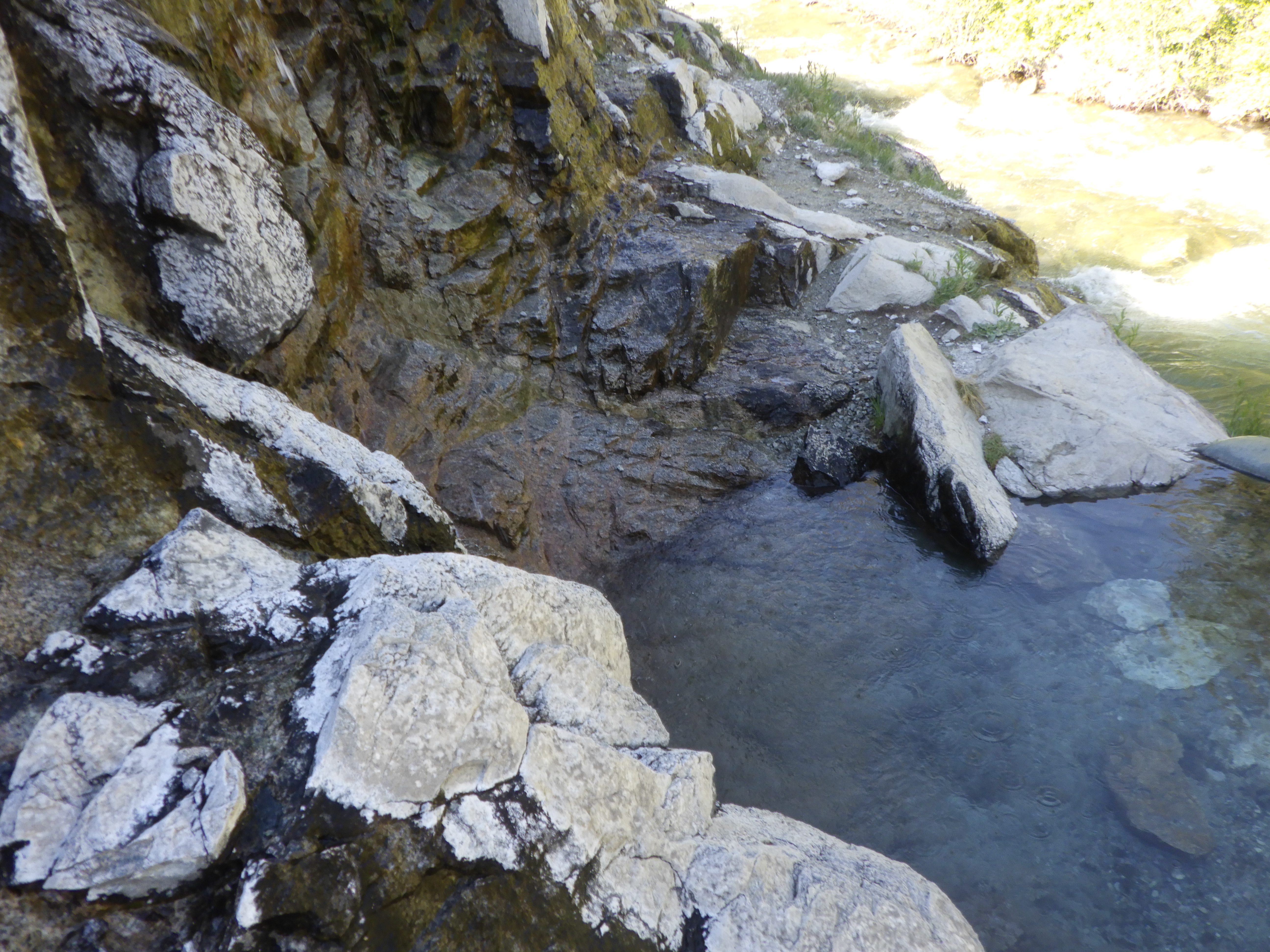
The Skillern Hot Springs are both easy to find and difficult to find. From the trail, there’s a path down to hot water springing out of the hillside. But that’s not really where you want to go. You have to go down, and then traverse across, climbing up some rocks before you come upon the pool. It’s the size of a fairly large hot tub, and on this trip it was in very good repair, with a line of sandbags keeping the water level nice and high. What I love about it is that the rocks from above overhang and shelter the pool so it feels like you’re out there completely alone. The river runs below and the hot water falls from above. It’s idyllic. 

The water temperature was good. Hotter than it had been September 2020, for which I was glad. While my friend liked that cooler temperature on that trip, I prefer it a bit hotter, and I got my preference on this trip. My niece thought the temp was good, but we both got a bit hot in it. I found a place where cool water was trickling down the rocks and showed it to her. We spent some time just hanging out in the water, watching the river and the few clouds that made an appearance overhead. 

Eventually, the heat was too much, and we retreated out of the water to cool off and head back. I was glad that there weren’t a lot of bugs there to bother us. Some years, I’ve gotten horse flies attacking as soon as I get out of the water, but they weren’t around this time. Thank goodness! 

She had wanted to know what the temperature of the water would be like where the hot springs met the river, so we checked that area out on our way back. The answer, basically, is half freezing cold and half boiling; the water temperature doesn’t blend very well right at the intersection of hot springs and river. Then we made our way back to camp and finished making up our beds for the night. I assured her that the air mattress she’d be sleeping on this night was much warmer than the one in the big tent, because it has insulation inside of it. Between the better sleeping pads and a warmer forecast (which surprised me because we were at a higher elevation), I was sure we’d be warm for this night. 

We decided to include more water in the Chicken Alfredo for the second bag. The first one was delicious, but they do have a tendency to have crunchy bits of chicken. More water helps, but there was still some crunch to the chicken. And then we also had a dessert to eat, a chocolate mudslide that I liked and she tolerated. The sun disappeared more quickly from this position, but it didn’t get truly dark until much later. 

As we were in the tent, I showed her pictures on my camera from past trips, cute things like flowers and animals mostly. Before it got fully dark, we went out for a last pee break before bed. That way she wouldn’t have to wake me up for company if she needed to go in the night. I usually have to get up and go at least once in the night, but I’m used to sleeping out in the kind of darkness you can’t get within hundreds of miles of Chicago. 

Before we fell asleep, but after it was fully dark out, I got us both out of the tent to look at the stars. That was one goal that I had for this trip, to show her what the stars look like when you have zero light pollution to interfere. The sky didn’t disappoint, displaying a myriad of stars, a bit of galaxy shading, some satellites, and a plane or two. The moon wasn’t going to rise until early morning, so we got the full show. We stood out there for quite some time, just looking. But I got a crick in my neck and started to get cold, so I called it and we went back into the tent for the night. 

I got us packed up while she slept in.

The sun was shining on our campsite.

I wanted to share this deer with her, but it disappeared too quickly.

I was quite proud of this breakfast burrito. 

We managed to set off from camp before noon. 

Some flowers along the trail.

Moving along the trail.

Time to pick, high road or low road.

No way we're fording that high water!

So we gotta take the high road.

Which does offer some great views, to be fair.

More shade after the high road.

We have arrived!

The hot springs don't look like much, unless you know where to go.

A nice reinforced ledge kept the pool's water level high.

Plenty of room to hang out in the hot spring.

I know I had a great time ;)

Last time I saw this, it was just a tub, but someone has gone to the trouble of wilding it. I like it.

A nice little camping spot.